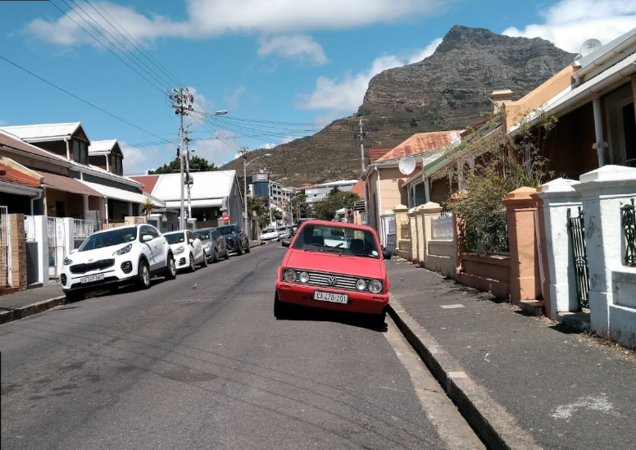
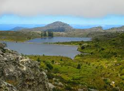
South African History Online
Towards a People's History
Politics & Society
Africa
Art & Culture
Biographies
Classroom
Places
Timelines
Archives
About Us
Tools
Cite This Page
Share
Print
Advanced Search
Timeline Explorer
✦
Contribute
Menu
Politics & Society
Africa
Art & Culture
Biographies
Classroom
Places
Timelines
Archives
About Us
✦
Contribute to SAHO
Home
SAHO global search
Fulltext search
Search fields
Content » Body
Content » Title
Content type
- Any -
Archive
Article
Biography
This day in history
Place
Upcoming Event
Sort by
Relevance
Random
Filter Results
Reset Filters
Recent Searches
Clear All
549
results found
Sort
Relevance
Newest First
Oldest First
Title A-Z
Did you mean:
?
Orange River
Place
… the Atlantic Ocean at Alexander Bay . At the source of the
Orange
River
, in Lesotho , which has an average rainfall of about … less than 50 mm per Year. The total catchment Area of the
Orange
River
(including that of a major tributary, the Vaal) …
Anniskop, Hill in Karoo-Namibia
Place
… Hill some 13 km North-West of the confluence of the Annis
River
with the
Orange
River
. Near the hill is the joining of the
Orange
River
and the Annis
River
which is known for its …
Green Lodge, 81 St George Street, Bloemfontein
Place
… Published July 14, 2011 Updated April 18, 2019 The
Orange
River
Convention (sometimes also called the Bloemfontein … the independence of the Boers in the area between the
Orange
and Vaal rivers, which had previously been known as …
Aliwal North, Eastern Cape
Place
… 20, 2016 Updated May 9, 2020 Town on the banks of the
Orange
River
, some 195 km from Bloemfontein, on the road to to East … springs and a good fording place ('drift') across the
Orange
River
, just below its confluence with the Kraai
River
. …
Aberfeldy a Settlement in the Free Sate
Place
… Land and Game Farms. The Farm 'Aberfeldy', in the
Orange
Free State had a Post Office known as … when the Railway reached the Farm in 1902, the new
Orange
River
Colony Administration preferred Aberfeldy. Which …
'Abbakwap' a Mountain were the Fish and Orange Rivers Merge
Place
… in the Richtersveld, at the confluence of the Fish
River
with the
Orange
River
. This a Khoikhoi name for 'Rooilepel', and means … Map Geolocation 'Abbakwap' a Mountain were the Fish and
Orange
Rivers Merge Language Not specified Most Read Off …
First Raadsaal
Place
… as a school. It was the first school building north of the
Orange
River
. It served as a church until 1852, and was then used by the Legislative Council of the
Orange
River
Sovereignty, and from 1854 by the Republic of …
The Old Presidency Museum, Bloemfontein
Place
… former residence of the President of the Republic of the
Orange
Free State from 1886 until 1899 when the city fell to … then the British Resident for the area North of the
Orange
River
, purchased it from the Brits family in 1846. The …
Bethulie Bridge across the Gariep River
Place
… Cape Provinces. The stone Bridge spanning the Gariep
River
at Bethulie Drift was opened to traffic in March 1879, … been established a short distance from the drift, in the
Orange
Free State, in 1829. The name was subsequently amended … been established a short distance from the drift, in the
Orange
Free State, in 1829. The name was subsequently amended …
The Queen’s Fort Military Museum, Bloemfontein
Place
… Fort. On 3 February 1848 the British declared the
Orange
River
Sovereignty, covering a broad area of land over the … during heavy rains in 1850 and when the Republic of the
Orange
Free State was established, it was taken over by …
Gordonia Division
Place
… Africa and Botswana. It is crossed from east to westby the
Orange
River
, whose banks and islands are farmed under irrigation … from north to south by the Molopo, which joins the
Orange
River
just north of Augrabies. The main industries are …
Lookout, Uitenhage
Place
… the farm \"Gouwernements Belooning\". A flooded Sundays
river
prevented him from reaching the farm and instead he … the Sundays
River
Irrigation Project and eventually the
Orange
River
Water Project. His name lives on in the town of … the animal Kingdom. A panoramic view of Kirkwood and the
orange
groves is visible from The Lookout, where James Somers …
Gariep River Mouth, Namibia
Place
… Published March 9, 2020 Updated March 9, 2020 The
Orange
River
, Southern Africa’s longest waterway, rises high in the … found typically in the marshes of a
River
Delta. The
Orange
has been called ‘The
River
of Diamonds’, stones from …
Goshen
Place
… arrived at the end of the railway line (which in 1885 was
Orange
River
Station; the bridge over the
Orange
River
had not yet been built), a party of Boers with …
The Fourth Raadsaal, Bloemfontein
Place
… fourth such to have been Built by the old Republic of the
Orange
Free State. Following the abolition of the
Orange
River
Sovereignty in 1854, the Republic's Legislative …
Amandelboom, Town in Northern Cape
Place
… name of this little Northern Cape Village on the Sak
River
, which began life as a Rhenish Mission station in 1845. … the Richtersveld, to the original
River
Snake abode, the
Orange
River
. There was once a mystical connection between … the Richtersveld, to the original
River
Snake abode, the
Orange
River
. There was once a mystical connection between …
Old Presidency
Place
… residence of the presidents of the former Republic of the
Orange
Free State, it was declared a National Monument under … (then the British resident for the area North of the
Orange
River
) purchased it from the Brits family in 1846. The …
Namaqualand, Flower Route
Place
… Africa. The Western boundary is the Atlantic Ocean and the
Orange
River
Mouth, is the Northern boundary. Namaqualand was … Africa (now known as Namibia ), is located across the
Orange
River
. Travel was by means of Pontoons, which occurred …
Dutch Reformed Church, Pretoria East
Place
… is at the foot of Table Mountain and along the Liebeek
River
. A Fort of Good Hope was built. With him, Van Riebeeck … part of the population moved across the Northern border (
Orange
River
) of the Cape Colony to the areas known later as the
Orange
Free State, Natal and Transvaal. Many new churches …
Abraham Fischer Men’s Residence, University of the Free State, Bloemfontein
Place
… on 16 October 1909 by the then Prime Minister of the
Orange
River
Colony, Abraham Fischer . The men's hostel and the main … on 16 October 1909 by the then Prime Minister of the
Orange
River
Colony, Abraham Fischer . The men's hostel and …
Agtersuurberg, Eastern Cape
Place
… Gariep Dam on the 4 October 1996. Gariep is Khoekhoe for '
river
' and was the original name of the
Orange
river
. Gariep Dam Image source Location Map … Emergency treatment of unrest victims in the eastern Cape
Orange
River
'Abbakwap' a Mountain were the Fish and
Orange
…
Houses Brill and Andrew Murray, together with Tuck Shop, Grey-College, Bloemfontein
Place
… opened on 19 December 1907 by the then Governor of the
Orange
River
Colony, Sir Hamilton J Gould-Adams. The tuckshop … opened on 19 December 1907 by the then Governor of the
Orange
River
Colony, Sir Hamilton J Gould-Adams. The tuckshop …
Free State Province
Place
… the hollow of its bean-like shape. Lying between the Vaal
River
in the North and the
Orange
River
in the South, the region is flat with rolling … in the Great Trek, some of them settled just north of
Orange
River
, which formed the border between the Cape …
Alexander Bay, Namaqualand
Place
… this Seaside Town that lies on the mouth of the Mighty
Orange
River
– the
River
that feeds the Gariep and Vanderkloof dam … flaking ribs. The Cove on the Coast, 7 km South of the
Orange
River
mouth. The Area has the richest alluvial diamond …
Pretoria, now known as Tshwane
Place
… Tshwane . Pretoria stretches along both sides of the Apies
River
and extends into the Western Hills, of the Magaliesberg … for South Africa and Governor of Transvaal and
Orange
River
Colony was responsible for the design and … for South Africa and Governor of Transvaal and
Orange
River
Colony was responsible for the design and …
Upington, Northern Cape
Place
… of South Africa. It was established on the bank of the
Orange
River
in 1870. By uniting Christian Schröder’s 1871 Mission … Station now houses the Town Museum, known as: 'Kalahari
Orange
Museum'. The Museum is also the Home of the famous …
Vaal River and Dam, Gauteng, Free State, Northern Cape and Mpumalanga
Place
… major sources of drinking water , it lies on the Vaal
River
close to Vereeniging , midway between the N1 and the … meetings!) The Vaal
River
is the Northern tributary of the
Orange
River
. Rising at Sterkfontein Beacon, near Breyten , … it flows 1,210 km Southwest to its confluence with the
Orange
River
, near Douglas. The Vaal's middle section forms …
Pella
Place
… Palestine refuge for Christians crossing the Jordan
River
in flight. (prior to 1910) In 1806 the first stationof … the London Missionary Society (L.M.S.) north of the
Orange
River
wasestablished at Warmbad in South-West Africa, … the London Missionary Society (L.M.S.) north of the
Orange
River
wasestablished at Warmbad in South-West Africa, …
Raadsaal, 95 St George’s Street, Bloemfontein
Place
… as a Council Chamber for the Legislative Assembly of the
Orange
River
Sovereignty , who held its sessions there from … here. Following the establishment of the Republic of the
Orange
Free State in 1854, the hall continued to serve as the …
Table Mountain Water Supply
Place
… streams flowing off the mountain: to the North the Vasche
River
, to the East the Liesbeek; South-East the Diep and Spaanshemat
River
, whilst the Disa
River
emerged from
Orange
Kloof and ran South-West. The most important
river
, … was built in Hof Street in 1814. Iron pipes were laid in
Orange
, Long and Strand Streets and a number of fountains …
Current page
1
Page
2
Page
3
Page
4
Page
5
Page
6
Page
7
Page
8
Page
9
…
Next page
››
Last page
Last »
Related Searches
Cite This Page
APA (7th edition)
Copy APA Citation
Oxford (Footnote style)
Copy Oxford Citation
Harvard
Copy Harvard Citation
Referencing Resources for Historical Research
Share This Page
Share this page with your friends and colleagues:
Copied to clipboard