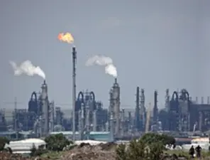
One of them is a low-level bridge crossing the Crocodile River that serves as the entrance to the Kruger National Park's-'Crocodile Bridge Rest Camp', (for further details about this camp refer to the Link in FURTHER READING). It's a popular spot for game viewing and is known to flood during the rainy season. (as show in the other picture). The Historical Railway Bridge was Constructed in 1894 and was completed just before the end of the 19th Century. This bridge across the Crocodile River is visible from the rest camp, once formed part of the Selati railway line that wound its way through the Park to Skukuza. This was the Railway Line from Komatipoort to Newington (now in the Sabie Sand Game Reserve) was completed – with exception of Sabi Bridge at Skukuza where a temporary wooden bridge was in place.
During the 18th Century, European explorers were lured inland by legends of the fabulous gold riches of Monomotapa. They came into conflict with the local inhabitants whose traditional way of life was threatened by these unknown visitors, from across the sea. This Railway Bridge known as the Broederstroom Bridge, has steel girder on either side. This bridge was built in the 1920's and includes concrete spans to reach higher ground. The bridge is in sound condition. It would seem that it is still in limited use. Crossing the bridge the old path ends on a private property.
Francois de Kuiper of the Dutch East India Company led the first expedition to the area from the Cape in 1725. His party was attacked by local inhabitants in the Gomondwane bush (just North of Crocodile Bridge), and forced to retreat to Delagoa Bay.
When the Sabie Reserve (a forerunner of the Kruger National Park) was proclaimed in the late 19th Century. Crocodile Bridge was one of the first of four Ranger Posts. This particular bridge once formed part of the Selati Railway Linethat wound its way through the Park, to Skukuza. Construction of the bridge started in 1894 and was completed just before the end of the 19th Century. The bridge continues to be used despite being badly damaged, in severe floods during February 2000.
In 1940, ranger Sinias Nyalunga was awarded the Bronze Medal of the Royal Humane Society for risking his life to dive into the river to rescue a woman and her baby who had been swept off the bank by floodwaters. The Crocodile River would almost certainly have been the Northern most border with Swaziland, had a rather dubious 19th Century land deal, not been conducted between the Transvaal Land Commissioner, Abel Erasmus and an unnamed Swazi chief, in which the Swazi border was pushed 80km Southwards, (this was done in leu of the exchange for 12 cases of gin.)
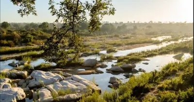
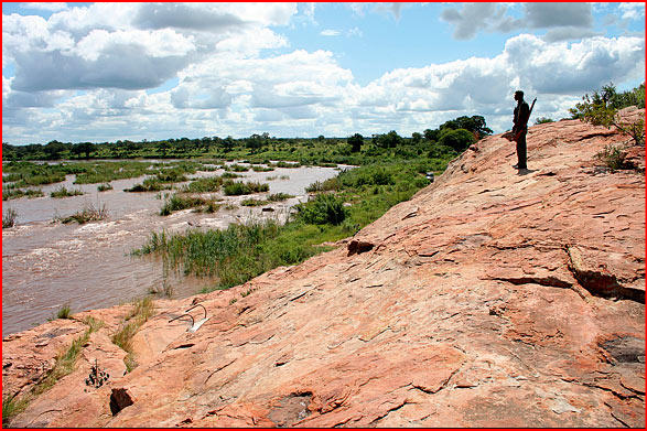
The Crocodile Bridge is an open Area of grassland and dense thorn thickets. It's one of Kruger's driest areas - receiving about half the average Park rainfall. The Gate is named after the Crocodile River, which forms the southernmost boundary of the Kruger Park. The River gets its name from the number of crocodiles that it has and would certainly be one of the most dangerous to try to wade across. Crocodile Bridge is the most direct access point to the game-rich South-Eastern grasslands of the Park and sighting opportunities open up very quickly after entering the Park!
The game drives here are part of what is known as the "Southern Circle" which has a reputation for good lion-spotting. Several prides operate in this area, each with its own distinct hunting techniques and behaviour patterns. In recent times, this has often led to problems of lions crossing the Crocodile River and attacking livestock outside the Park. At one point during the early 1970's, the situation got so bad that 26 escaping lion had to be shot during an 18-month period. The Crocodile Bridge area also has the highest percentage of Kruger's White Rhino population.