Skip to main content
South African
History Online
Politics & Society
Africa
Art & Culture
Biographies
Classroom
Places
Timelines
Archives
About Us
Cite This Page
Share
Print
Timeline Explorer
♥
Donate
South African History Online
Know your
history
Search SAHO
30,000+
Archive records
17,000+
Historical events
10,000+
Biographies
2,800+
Articles
Trending topics
Apartheid
Nelson Mandela
Freedom Charter
Sharpeville
Steve Biko
Anglo-Boer War
Mandela
Zulu
Browse by era
Pre-colonial
Colonial era
Apartheid era
Liberation struggle
Post-1994
World Wars
Explore by type
Politics & Society
Biographies
Timeline
Archives
Classroom
Recent searches
Menu
Politics & Society
Africa
Art & Culture
Biographies
Classroom
Places
Timelines
Archives
About Us
Home
District
Sort by
Date
Order
Asc
Desc
Browse Content
Archives
Collections
Place
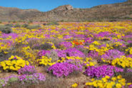
Namaqualand
9 April 2026
When the settlement was founded at the Cape the officials there soon learnt of the existence of, Copper somewhere to the...
Place
Aakaap/Rietfontein, Northern Cape
16 March 2026
Rietfontein is a Town in ZF Mgcawu District Municipality, in the Northern Cape province of South Africa. It functions as...
Place
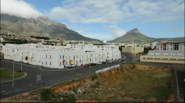
District Six, Cape Town
9 March 2026
District Six was a multi working-class area just off the centre of Cape Town, to the South of the Castle. Today it is an...
Place
Vhembe District Municipality
26 February 2026
Vhembe District Municipality with its head quarters in Thohoyandou was established in 2000 through the process of transf...
Place
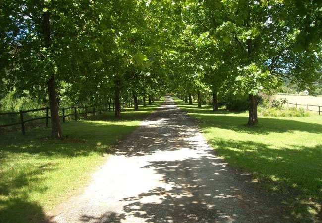
Curry's Post
6 January 2026
Curry’s Post is a beautifully scenic area in the heart of the Midlands Meander that lies between Mooi River and Howick. ...
Place
Allemansfontein, a Farm in the Eastern Cape
10 December 2025
Allemansfontein is a farm in Blue Crane Route Local Municipality, Sarah Baartman District Municipality, Eastern Cape
Place
Glen Grey Division
1 December 2025
The frontier war of 1850-53 was precipitated when the amaNgqika, faced with the increased pressure of European settlemen...
Place
Nqamakwe
1 December 2025
In 1865 a number of Mfengu clans were resettled in the area around Nqamakwe. As refugees from the Mfacane wars further n...
Place
Helderberg, Somerset West
11 August 2025
The district takes its name from the mountain of the same name, which is Afrikaans for "clear mountain", referring to th...
Place
Ntabankulu Municipality
2 August 2025
Ntabankulu is an isiXhosa word meaning "great or big mountain", since the municipal Area is mountainous in character. Th...
Place
Alfred Nzo District Municipality, Kwa-Zulu Natal/Eastern Cape
2 August 2025
District of which, Harding is the principal town. Encircled by Mount Currie, Umzimkulu, Ixopo, Port Shepstone and Bizane...
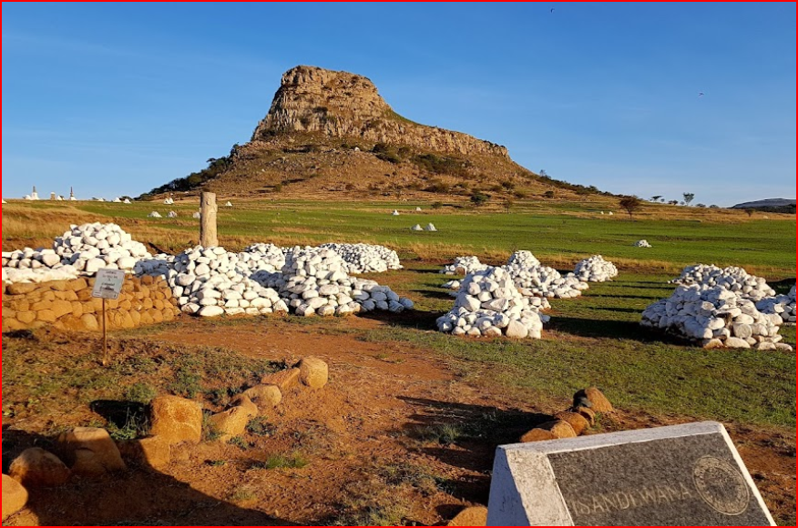
Place
Isandlwana Battlefield Site, Nqutu
31 March 2025
Nquthu is an isiZulu name meaning "the back of the head". Umzinyathi District has a total area of 8 079 square Kilomet...
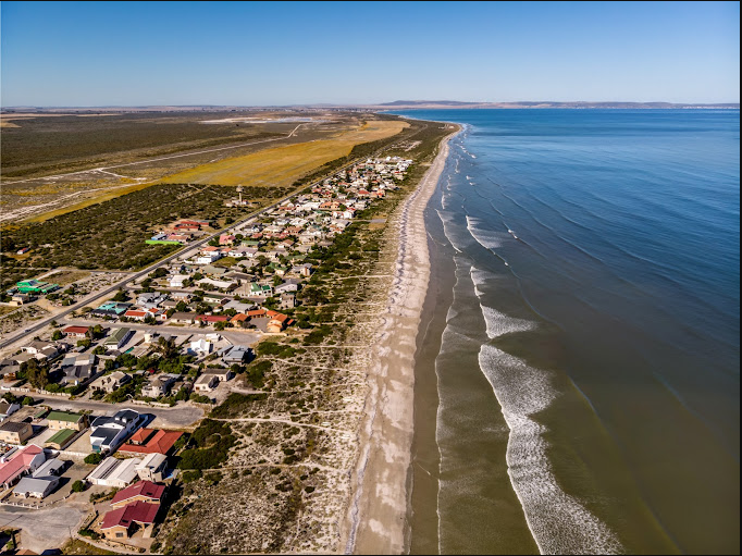
Place
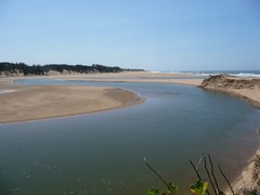
Dwarskerbos Beach and Pools, West Coast
5 February 2025
The Portuguese navigator Vasco da Gama first set foot on South African soil on 7 November 1497 near here, when he explor...
Place
Oliver Tambo District Municipality
20 September 2024
The OR Tambo District Municipality (ORTDM) occupies the eastern coastal portion of the Eastern Cape Province, bordered b...
Place
Gold Reef City
15 April 2024
Gold Reef City is a re-creation of turn-of-the-century Johannesburg, which was flooded by prospectors after the discover...
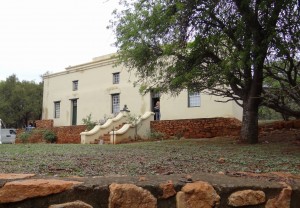
Place
Boekenhoutfontein, District of Rustenburg
12 April 2024
It was declared a National Monument under old NMC legislation on 2 April 1971.
Place
Observatory
29 January 2024
Observatory was a residential suburb of Cape Town, and derived its name from the Royal Observatory, which was establishe...
Place
Albertinia, Mossel Bay- The Garden Route
10 January 2024
Village some 50 km West of Mossel Bay. It was laid out in 1900 on the farm Grootfontein and became a Municipality in 192...
Place
Swellendam
29 December 2023
Founded in 1743 by the Dutch East India Company, it was named after the Cape Governor, Hendrik Swellengrebe and his wife...
Place
A History of Ottosdal and Letsopa
23 November 2023
Precolonial and Early History Almost four hundred years ago, Khoe-San people moved into the interior of South Africa ...
Place
Malay Quarter, Cape Town
21 April 2023
The area, known as the Malay Quarter of Cape Town, nestles against the steep slopes of Signal Hill. It formerly covered ...
Place
Gouda, Cape Winelands
13 January 2023
Gouda is a little Village just 37 km South of Porterville, at the Western entrance to the Nuwekloof Pass that links; Tul...
Place
Odendaalsrus, Free State
26 August 2022
Having been established in 1912, this is the oldest gold mining Town in the District. The Town was a group of Farms with...
Place
Mogodi Village
7 July 2022
The Orrie Baragwanath Pass is a rough dirt road across the Wolkberg mountains in the scenically rich Lekgamaleetse Natur...
Place
Mobeni
7 July 2022
Mobeni, is located in KwaZulu-Natal, Durban (formerly Port Natal). The largest City of KwaZulu-Natal Province and chief ...
Place
Ngema Tribal Trust, Mpumalanga
29 October 2021
Ngema Tribal Trust falls under the, Mkhondo Local Municipality Gert Sibande District Municipality in Mpumalanga , South ...
Place
Kopanong Local Municipality, Free Sate
3 March 2021
The Kopanong Local Municipality is a Category B Municipality situated within the Xhariep District of the Free State Prov...
Place
Riversdale Division, Western Cape
23 October 2020
The Division of Riversdale was originally located on the Eastern boundary of the District of Swellendam, which had been ...
Place
Cathcart District, Eastern Cape
21 September 2020
The District of Cathcart was created in January 1877, and it was raised to a fiscal divisional on 1 December 1879. Its e...
Place
Carnarvon District, Karoo
21 September 2020
The district of Carnarvon was proclaimed on 1 January 1880, incorporating within its boundaries portions of the division...
Place
Carlisle Bridge, Eastern Cape
21 September 2020
Carlisle Bridge is a District of Farmsteads and is known as Carlislebrug. It is located in the Cacadu Municipality ...
Place
Maluti-a-Phofung Municipality, Free State
27 July 2020
It is bordered by Phumelela in the North, the Kingdom of Lesotho in the South, the KwaZulu-Natal Province in the East, a...
Place
Anhalt-Schmidt, a Mission Station in Little Karoo
8 June 2020
Station of the Berlin Missionary Society in the Uniondale District. Named after the German Missionary- Schmidt. Wh...
Place
Amanzamnyama, a small size Town in Kwa-Zulu Natal
20 May 2020
An old Mission Station that takes its name from the nearby stream. The name means 'black water', from Zulu.
Place
Amanxala, a Farmstead in Mpumalanga
20 May 2020
Locality about 6 km North of Sibayeni and 24 km South of Komatipoort. The name is Swanzi for the 'grey rhebuck'. Am...
Place
AMabele, Eastern Cape Railway Station
18 May 2020
Railway Station 14km South-East of Stuterheim on route to Kei Road. The name is of Xhosa origin and refers to the A...
Place
Alkmaar, a Town Near Nelspruit
14 May 2020
A small Community on the Crocodile River, some 18 km from Nelspruit. Named after a city in the Netherlands which is 32 k...
Place
Alice, a Town near East London
8 May 2020
Town in the Victoria East District, on the Tyume River, some 120 km North-West of East London. It was named in 1847...
Place
Agtersuurberg, Eastern Cape
23 April 2020
Early name for the present Venterstad district, Eastern Cape. It was laid out in 1875 and attained municipal status in 1...
Place
Kweneng, District of Botswana
25 November 2019
Kweneng is one of the districts of Botswana and is the recent historical homeland of the Bakwena people, the first group...
Current page
1
Page
2
Next page
››
Last page
Last »