The Northern Cape is the largest Province in South Africa, but has the least number of inhabitants. Before 1993 it was part of the Cape Province (under old Provinces).
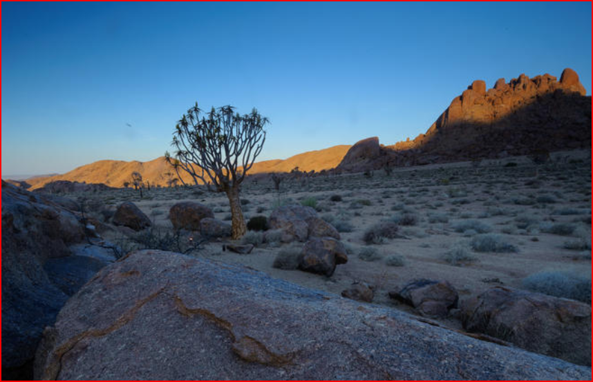
"With only a million people inhabiting its 373,000 sq km, the Northern Cape is South Africa’s last great frontier. Its scattered Towns are hundreds of Kilometres apart, connected by empty roads across the sublime, surreal wilderness expanses of Namakwa, the Kalahari and Upper Karoo. Under the remorseless sun, vehicles share park roads with lions, dune boards swish down roaring sands, and Kimberley’s pubs serve cold beer as they have since the 19th-Century diamond rush."
The land is mostly desert, including Namaqualand, great parts of the Karoo and parts of the Kalahari desert. These deserts were the home of many Khoikhoi and San groups, and there are still examples of San Rock Art.
When you are traveling North from South Africa and crossing a Namibia Border Post, it doesn’t have to cause a headache, whether you’re driving with a rented 4×4 or just taking your own trusted sedan. In the Western part of the Province, the Northern Cape also shares a border with Botswana. The shared Area is part of the Kgalagadi Transfrontier Park, an International Reserve, that spans both Countries.
Capital: Kimberley
Principal languages: Afrikaans, English, isiXhosa
Premier: Sylvia Lucas
First premier (1994): Manne Dipico
The Northern Cape's claim to fame:
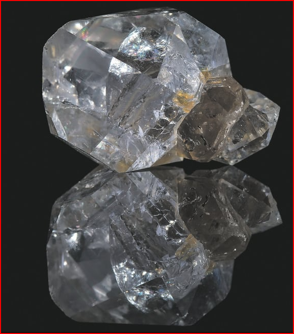
Diamonds
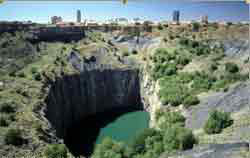 The Big Hole of Kimberley. Source: Microsoft Encarta World Atlas 1998 Edition
In 1867 diamonds were discovered at Hopetown and then at Kimberley. People from all over the world came to Kimberley to mine for diamonds. Thousands of miners started digging in the ground. They created a big hole that grew as they dug deeper and deeper to find diamonds. This became the biggest hole made by men in the World. It is called the Big Hole of Kimberley. Mining there stopped in 1914, and today there is a Museum where people can see how the Town of Kimberley looked 100 years ago.
Find out more about the discovery of diamonds in South Africa.
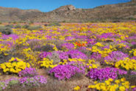
Namaqualand flowers
 Namaqualand flowers
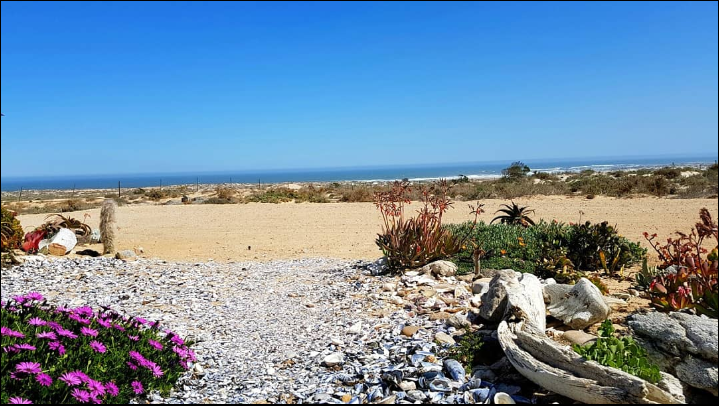
The wild flowers of Namaqualand are part of South Africa’s natural Heritage. In spring, Namaqualand desert becomes very colourful when all the flowSkilpad Walking Trail. In spring, millions of daisies, 'vygies'-(‘Mesembryanthemum’ are one of South Africa’s most colorful plant groups. They are drought tolerant, a low-growing succulent and produces pretty daisy-like flowers. Keep the seeds misted (moist) to encourage germination (7 – 14 days) and succulents burst into a fiery carpet of colour across rolling hills and quartz-strewn plains.
SKILPAD WALKING TRAIL- The path is well-marked with tortoise emblems, offers panoramic views of Kamiesberg Peaks like Osseberg and the ‘Roof of Namaqualand’ and is a hotspot for spotting: "Gemsbok; Springbok; Klipspringer and Endemic Birds". You need to book ahead- sign in at the Skilpad Office for a map, bring water and sun protection. It’s a compact yet unforgettable immersion into SA’s legendary flower season. This is one of the best hikes in South Africa you can do as a beginner hiker. Every year, many tourists from all over the World come to Namaqualand to see the flowers!
Anglo-Boer War battles
The Northern Cape was very important in the Anglo-Boer War. One of the biggest battles of the war happened at Magersfontein. The Boers won the battle with special new fighting techniques, like using trenches so that the enemy could not see them in an attack.
Corbelled houses
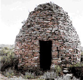
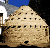 Two examples of Corbelled or Bee-hive houses in the Northern Cape. Photos taken by C. van der Walt
When farmers had to stay in the field to look after their animals, they built small huts to live in. But in the desert where there was no wood, they used rocks. These little houses looked like bee-hives, and were called corbelled houses (it means: 'beehive house'). There are still some of these special homes left in the Northern Cape, and they are a special part of our cultural heritage.
The Northern Cape occupies a central position in the global debate regarding the renewable energy contribution in South Africa. The Province is regarded as HOME to sustainable private investment in Renewable Energy and to date the Northern Cape is host to 59 of the Country's 112 Independent Power Producers with more than 23 projects already connected to the grid at a capacity of over 1500 MW. The Northern Cape has the potential to generate energy by means of Concentrated Solar Panels (CSP), Photovoltaic (PV) and Offshore Wind. An area of particular confusion for many bidders has been the economic development requirement accounting for a total of 20% of the net value of the Renewable Energy to Independent Power Producers Procurement Programme (REIPPP) proposals. The IPP is required to assess the needs of communities within a 50-km radius of their respective sites and prepare strategies on how to address the needs of the community's. What has been difficult for the IPPs is that the Department of Energy (DOE) has provided no guidance on how to prepare acceptable plans and how to demonstrate potential benefits. These IPP's had to go on the ground to assess the needs of the community. During the survey, IPPs indicated their willingness to work with the Municipalities in addressing the needs of the communities. Given the circumstances on the ground, one was able to learn more about the success stories as well as challenges!
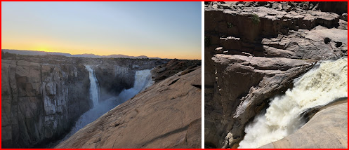
Oorlogskloof Rock Pigeon Route
Expect steep canyon climbs, natural rock tunnels, chimneys and ten stunning sandstone arches (with a healthy dose of scrambling) on this adventure so bring your a-game if you’re afraid of heights. You’ll overnight in basic huts (with bunks with mattresses) that can sleep 16 people at Brakwater (night one), Kameel se Gat (night two) Doltuin (night three) and Pramkoppie (night four). You’ll carry all your food and gas stove (no fires allowed) and refill water from rivers or springs. This is pure, wild South Africa at its most exhilarating and beautiful. (link in FURTHER READING)
The City of Matlosana municipality is located in the Dr Kenneth Kaunda District Municipality within the North West province of South Africa. Its administrative seat is the city of Klerksdorp. One South African city flushed R11 billion down the drain- Link availible in FURTHER READING.