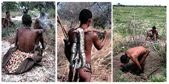
Kalahari Desert is basically, a large basin like Plain in the interior Plateau of Southern Africa. It occupies almost all of Botswana, the eastern third of Namibia, and the Northern most part of Northern Cape Province. In the South West it merges with the Namib, which is the Coastal Desert of Namibia. The Kalahari’s longest North–South extent is roughly 1,600 kilometres and its greatest East–West distance is about a 1000 kilometre in Area.
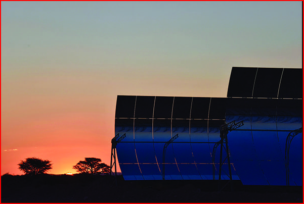
Renewable Energy- A greenfield concentrated solar power (CSP) project with innovative parabolic trough technology and a molten storage system has revitalized a remote region. But the project is also laudable for its social, economic, and environmental commitment to the unique region. The sun is characteristic of everything in Kathu which is a dusty hamlet at the heart of the Kalahari Desert. (LINK FOR IN FURTHER READING)
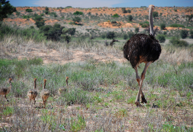
The Kalahari Desert is a featureless, gentle undulating sand-covered plain, which everywhere is 900 metres or more, above sea level. Bedrock is exposed only in the low but vertical-walled hills, called: 'kopjes'. These rarely but conspicuously rise above the general surface, though. Aside from these kopjes there are three surfaces that characterize virtually all of the Kalahari types of sand: 'Sand sheets; Longitudinal Dunes and 'Vleis' or Pans'.
- The sand sheets appear to have been formed during the Pleistocene Epoch Age (about 2,588,000 to 11,700 years ago). They have been fixed in place since then, in some areas they appear to have been of fluvial origin. This results in sheet flooding. In times of much greater precipitation, but by far the greater part of them were wind-formed! The sheets occupy the Eastern part of the Kalahari. Their surface elevation varies only slightly. In many Areas the sand is red which results in a thin layer of iron oxide that coats the grains of sand.
- The entire Western Kalahari Desert is characterized by long chains of dunes, oriented roughly to the North or North West. Each dune is separated from its neighbour by a broad parallel depression locally called a 'straat' (Afrikaans for “street,” or “lane”), this is because each constitutes the easiest way to travel.
- These Vleis, or Pans are features of the unique desert drainage systems and the “dry lakes” at the end of ephemeral streams. (Many are remnant features from an earlier period of greater precipitation. As very little water ever flowed to the Sea from the Kalahari.) Rather occasionally each Stream ended its course in a slightly lower depression from which there was no outlet. There, as the stream dried up, the fine silt particles carried in suspension by the sluggish stream were deposited with soluble calcium minerals and salts precipitated out of the evaporating water. The results are Pans or flat surfaces. These are devoid of vegetation and are gleaming white, when dry. They are hardened by the cementing action of the soluble minerals and covered by a shallow layer of standing water. Where the salt content is low, pans may become covered with grasses after a rain.
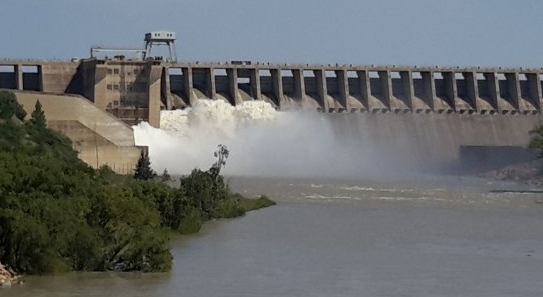
In the Northern Kalahari an extraordinary drainage system prevails. During the summer heavy rains fall on the uplands of central Angola, far to the North West of the Kalahari. Large amounts of runoff water feed off a number of south-flowing streams, which merge to form the Okavango and Cuando Rivers also known as the Kwando River. The Okavango flows to the South East and into the Northern most portion of the Kalahari, eventually breaking up into a number of distributary channels and feeding the vast area of Swamps in Northern Botswana. After an abnormally wet rainy season in Angola, excess water fills the Swamps and they overflow. Ultimately filling Lake Ngami farther to the South. Then flowing Eastward through the Boteti River into Lake Xau and the Makgadikgadi Pans. Similarly, the Cuando River flows South from Angola and partly into a North Eastern extension of the same Swamps. (Read the PDF In FURTHER READING)
Kalahari Red Dune Hiking Traverse
This multi‑day trek takes you across blazing orange dunes, shimmering salt pans, mysterious black rock formations of the Lost City and sparse acacia plains – a rare chance to walk through one of the world’s most untouched desert landscapes. Over 5 days, you’ll stay in comfortable lodges (complete with hot showers and real beds), enjoy game drives and see meerkats and camels. You’ll need to book in advance, be fit for sandy terrain and carry water and sun protection – promising an unforgettable desert odyssey under endless skies and fiery sunsets. ( link in FURTHER READING)