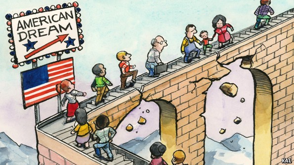
Fernkloof Nature Reserve, Caledon

Early in the nineteenth Century, Hermanus Pieters, used to walk ‘over the mountain’ from Caledon, year after year, to camp at the coast and enjoy the abundant fish and shellfish he found there. A shell was discovered on Hoy’s Koppie, and it tell us that 50 000 Years earlier, other people had also found Hermanuspietersfontein a good place to live. From the nineteenth Century into the twentieth Century, the Village grew apace. Eventually some far-sighted residents recognized the botanical richness of the area in which they lived and realised the need for preserving what they could for posterity. Three special men were responsible for the establishment of a Mountain Reserve above a then small seaside, Town. Otto J Prillewitz, Mayor of Hermanus, pushed it through administrative channels. His love for the environment had brought him into touch, Dr Ion Williams, botanist and former acting Mayor. Eric Jones was the third player in this environmental drama, nurseryman and founder/chairman of the Hermanus Botanical Society, in l960. In the same year, Doc and Eric dreamed up the idea for a cliff path along the coast and began plans for a botanical centre in the newly-established reserve. Fernkloof did not resemble the nearly 2000-hectare sweep of mountain and coastal fynbos encompassing some of the Kleinrivier range and most of the completed cliff path which forms its boundaries today. Then it was a mere 100 hectares in size, starting at a gravel pit used for making bricks and not much more. A Fernkloof Advisory Board was formed on which Prillewitz, Jones and Williams served. While Eric wrestled with the administration, Doc, a qualified civil engineer, took on the task of laying out paths. Harry Wood who had been appointed as the Curator of Fernkloof had been told to establish a garden using plants from the Caledon division.

A small nursery was started to supply his needs and water came from the Rockfill Dam and from a well behind the present Botanical Centre. But when in l971, the size of the reserve increased dramatically to 1440 hectares, all efforts were concentrated on the paths and removal of alien vegetation. The gardens were allowed to fall into jungle status until they were lovingly restored again from 2003 onward. In the 70's Botanical Society efforts succeeded in erecting a Centre which included an 'her-barium' (which is a collection of dried plant specimens mounted on sheets of paper), lecture hall, office and kitchen. A visitors’ Centre was built further up the road from which trails radiated and a weekly display of wildflowers became a feature – and still is. Today the Reserve has more than 60 km of graded paths and the 'her-barium', having been awarded international status and houses 3500 pressed specimens. A small hut was built on Galpinkop for the overnight use of members and visitors. The indigenous plant nursery does a thriving business. The cliff path, started in 1960, meanders 11 km along the coast from the New Harbour to Piet-se-Bos – most of it forming part of the reserve. It has wheelchair paths and bridges, thanks to the efforts of the Cliff Path Management Group, working under the auspices of the Botanical Society. They have come a long way from 1923. William Paterson, took local wildflowers to England and won a cup. He was secretary of the Horticultural Society founded the following year and is credited with finding the elusive Marsh Rose – and losing it to fire. Flower shows were held sporadically over the following years – in halls and hotels. The first, held in Allen’s Bio-scope Hall, raised 73 pounds 18 shillings and ten pence. Last year more than R 100 000 was raised towards conservation and Eco-education at the Hermanus Flower Festival in Fernkloof. Jose Burman, in his book on Hermanus, quotes Ion Williams as saying in those early days: “We thought we were going to turn Fernkloof into a lovely garden – we knew nothing about conservation.” A sundial in front of the botanical centre in memory of Otto Prillewitz bears testimony to his love of Fernkloof.

Geolocation
-34° 23' 38.4", 19° 15' 46.8"

Redelinghuys, Cape West Coast

Lying about two Hours' drive from Cape Town, Redelinghuys is known as the 'potato Capital', of the Sandveld. It lies on the R366 between Picketberg and Velorenvlei, North of Aurora and on route to Elands Bay, (if you like detours).

The Village itself is quaint and charming with beautiful scenery and, as with most Villages in South Africa, dominated by a magnificent Church on its main street, with plenty of Victorian Architecture (to satisfy your craving for sumptuous, historical surrounds!)

The Village started its life, as part of the Farm; 'Wittedrift'. Today, it is used mainly by those in search of time out, a sojourn in the Country and those who want to spend time at Velorenvlei Estuary, one of the largest natural Wetlands and a RAMSAR protected site.

From July through to October this part of the World is a floral tapestry to which Hikers and Nature Lovers, are drawn. Visit Redelinghuys, to see: the Dutch Reformed Church and Bell; the old Church; the Old Pastorate, which is now a guesthouse. 

It is a Village which lies among the Citrus, Vines, Vegetables and Potato Fields, (that provides an escape that City dwellers are after!)

 "Just about the only thing from which the Village seems to suffer is its ambiguity – not many people know about it – and there are many, who after discovering the little Village, are only too pleased that it remain this way!"-International Women’s Day is a time to reflect on progress made, to call for change and to celebrate acts of courage and determination by ordinary women, who have played an extraordinary role in the history of their countries and communities!

Geolocation
-32° 28' 59.8073", 18° 32' 2.4"

Strand, Cape Province

Lying at the foot of the Hottentots Holland Mountains, between Macassar and Gordons Bay and just 40 minutes’ drive from Cape Town, Strand is a town in its own right and a bustling one at that. New Dubai-style apartment blocks have joined the ranks of 70's-style beachfront homes to give the Strand beachfront a modern face lift. The Strand, Strand’s beachfront, is 5 km of white sand that is a water sports magnet and among the safest swimming beaches in the country. The Beach in Strand is warm, sheltered and lie on the edge of a promenade that includes a few coffee shops, cafes and restaurants. There is also a large entertainment area with putt-putt, a water slide, a heated Olympic-size swimming pool and tidal pool, which should keep most of the family amused.
Strand’s beginnings were as a fishing and holiday resort and things haven’t changed other than the development that has placed Strand at the heart of the beautiful Helderberg Basin with easy access to wine routes, Somerset West’s Mall and the coastal drive past Gordon’s Bay to Betty’s Bay providing perfect viewing points during whale watching season.
Fishing can still be arranged along the stretch of coast between Lourens River Mouth and Rooi Els as well as diving trips, and if you need to get away from the beach and its attractions, Stellenbosch is 25 km away and Cape Town and her attractions an easy drive along the N2.

Geolocation
18° 48' 43.2", -34° 7' 1.2"

Van Reenen's Pass, KwaZulu Natal

Named after the little Town of Van Reenen, which seems to stand guard at the top of this majestic Pass which winds its way through the Drakensberg Mountains between Ladysmith and Harrismith along the N3 between Durban and Johannesburg. Unfortunately, the only record that the pass can lay claim to is that of the most dangerous Pass in Africa! Despite this, the long pass provides beautiful scenery as it descends towards Ladysmith in the KZN Midlands from the Free State.

Durban - Most people just cruise over the Drakensberg Mountain passes on trips between Durban and Johannesburg but many are unaware of the History of these access Ways.

Durban-born and bred septuagenarian, Gillis van Schalkwyk, has spent much of his life exploring them and their History, and wrapped his knowledge into a self-published book, Drakensberg Passes, that came out this year, his research funded by the 'N3TC' toll company. Van Schalkwyk challenges some versions of History in his books, such as that “General” Frans van Reenen after whom the Pass was named. He was a miserable fellow, that he was to steal his son’s fiancée – was neither a general nor did he introduce the apartheid-era law which prohibited Indians from staying overnight in the Orange Free State. “His great grandson Dirk van Reenen claims Frans introduced the notorious law… Further investigation showed this was incorrect. That proclamation was drawn up and implemented in 1888,” writes Van Schalkwyk. “This law was infamous for Indians in general, but more problematic for the local Indians of Van Reenen, where portions of the village were in KwaZulu-Natal Province and portions in the Free State Province.

That meant they had to close up business at 6 pm, when the proclamation took effect each night, and retreat back to Natal just a few metres away.” The Town of Van Reenen has a History steeped in the Anglo-Boer War, and a lookout point, called ' Windy Corner', about 3 kilometres out of Town with views over the Mountains and lower lying Regions - virtually all that there is to the Town’s credit, apart from the Llandaff Oratory - a small chapel with only eight seats built by a father in memory of his son, and ostensibly the smallest Roman Catholic Church in the World.

Geolocation
-28° 23' 27.6", 29° 23' 13.2"

Magaliesberg Region, North West Province

Go on a journey through the Ecology and Geology, of one of the oldest Mountain Ranges in the World – estimated to be 2,500 million Years old, is the majestic Magaliesberg. Located in the Magaliesberg Biosphere Reserve, the Magaliesberg Canopy Tour is just 1 ½ hours from Johannesburg and 1 hour from Pretoria.

The Magaliesberg Range is home to a wide variety of plant, bird and animal life. With some luck, you may spot a Duiker or a shy Klipspringer jumping from rock to rock. Look up and you are likely to spot our breeding pair of Black Eagles circling above. Rock Rabbits (Dassies) are abundant and, depending on the time of day, they may be running around playfully or lazing in the sun on an exposed rock.

Magaliesberg has an established route through a wooded and often Mountainous Landscape making primary use of zip lines and aerial Bridges between platforms built in trees. Eager but nervous adventuresses, are harnessed to a steel cable without interruption throughout the entire tour for safety. "Zip-lining” is the act of gliding along a suspended cable (i.e., the term “zip-lining” refers to the activity itself), whereas references to “canopy tours” describe opportunities to participate in the zip-lining activity. (The distance from Sun City to Magaliesburg is 85.4 kms.)

Safety has always been our top priority and you can rest assured that it remains our primary concern. Posted on Facebook on the 18/3/2020 at 9 am: "In response to the national state of disaster declared by our President on Sunday due to the threat posed by the Coronavirus, COVID-19 and in line with Canopy Tours South Africa the following precautions were taken:

✅ implementing strict hygiene measures as recommended by the World Health Organisation (WHO) and the Department of Health.

✅ abiding by all recommendations made by the Department of Tourism and any further procedures issued by the Department of Health

✅ identifying clients who may have been in high-risk regions recently (the past 14 days) and rescheduling their Canopy Tour or refunding them in full.

✅ monitoring closely the health of our guides and staff: testing, self-isolation or quarantine will be implemented where necessary.

✅ "introducing private tours so that you can zip-line exclusively as a family or group of friends. In addition, we are stringently following developments on a Local and National level and have daily meetings to ensure we respond quickly to any changes and will keep you updated in turn. This way we can continue to operate as safely as possible and offer our guests the opportunity to get outdoors, soar through the ancient Magaliesberg mountains, see some wildlife and enjoy the thrill of zip-lining with us."

Geolocation
-25° 44' 56.4", 27° 47' 45.6"

Sterkfontein Dam, Free State

The vast expanse of water which is the Sterkfontein Dam lies a few kilometers from the edge of the Drakensberg Escarpment in the topmost reaches of the Vaal Dam catchment on the Nuwejaarspruit. The cool, fresh, deep waters are ideal for trout and other fish and it is a popular angling spot. It is the third largest dam in South Africa providing a perfect playground for sailing and other water-sports. The surrounding landscape is scenically stunning - characterized by rugged Mountains, lush ravines and rolling Grasslands.
In this beautiful setting is the Sterkfontein Dam Reserve covering 18 000 hectares. Perfect for long walks, hiking (there is a two-day hiking trail) and biking, it also offers excellent game viewing and bird watching. You can tick off Oribi, Reedbuck, Mountain Reedbuck, Grey Reedbuck, the blue and White bellied Korhaan, the bald ibis, the Buff-streaked chat, the ground woodpecker, and the sentinel. Gaze up to the sky and you could spot Cape and bearded vultures, as well as black and martial eagles soaring. Secretary birds can also be spotted in treetops or stalking in the grasslands.
The precipitous Ravines are populated with yellowwood, Koko, Wild Peach, silky bark, and black bark trees as well as bush Guarri. Wild grapes have grown up into the tops of the trees forming a dense canopy of leaves. Fungi and lichen sit against rotten and living tree trunks alike. The mountain slopes are adorned with wild myrtle, silver Sugar-bush Ouhout, Highveld Protea, Redwood, Hush Guarri, and the Tree Fern.

Geolocation
29° 1' 12", -28° 26' 52.8"

Bethlehem, Free State

Bethlehem is located on the N5 road to the Free State provincial capital Bloemfontein via Senekal and Winburg to the N1. Other regional roads in the Town are R76 road to Kroonstad (North), the R26 road to Reitz and Fouriesburg (North East and South) respectively. The R712 runs through to Clarens just 41 km’s away on route to the Golden Gate Highlands National Park. It falls under the Dihlabeng Municipality.
Bethlehem was founded by three local residents, Kristiaan Klopper, Neil Bishop and Henco Cronjé, who jointly bought the Farm: 'Pretorius Kloof'. The first stands were sold in 1860 and a Justice of Peace was appointed, in 1864
Bethlehem is 250 km North-East of Bloemfontein and 260 km South of Johannesburg, established in 1860 on the farm Pretorius Kloof and proclaimed in 1884. Named after the biblical Bethlehem (Judg. 17:7), the birthplace of Jesus. ‘House of bread’, so called because wheat was found to thrive there! Jordaan River rising in the Rooiberg North-East of Clarens and flowing north through Bethlehem. The reference is; to the River Jordan which flows into the Sea of Galilee. Asrivier River some 8 km South-East of Bethlehem, flows into Loch Lomond. Afrikaans for ‘axle river’, the name was given because the axle of a wagon broke at a ford here during the Great Trek,
causing some delay. Bethlehem was the temporary seat of the Government of the Orange Free State in 1900, during the South African War. The Town has railway Workshops, Cold-Storage Plants, flour mills, a dairying and malting industry, furniture-manufacturing plants, and textile mills. It is a centre for the distribution of agricultural produce and has major Rail, Air, and Road Links. The Pretorius Valley Bird Sanctuary has been created where the Jordaan River passes through Pretorius Valley, and Lake Athlone is a recreation area. Population according to the Census of (2001) is 11,819.
The casino is located in the historical town of Bethlehem and is the gateway to some of South Africa’s most beautiful scenery and important landmarks, including the Golden Gate Highlands National Park and the Basotho Cultural Village. Nearby outdoor entertainment options include river rafting, wildlife gazing, hiking, fishing, biking and quad biking.

Located in Bethlehem is also the 'Frontier Inn and Casino'. This is a charming, Boutique Casino Resort perfectly situated en-route to Clarens. Comfortable accommodation, lively entertainment, and service with a smile, characterize this frontier – themed establishment with its magnificent finishes. As the only legal casino in Bethlehem we offer gaming entertainment to excite with regular promotions and weekly game shows. Live the spirit of Adventure!
The Bethlehem Museum is one of Cultural History and is housed in the old Nazareth Mission Church on Muller Street. The church was originally built in 1906 so is architecturally and aesthetically pleasing. The museum is only open at selected times.
You will find a number of historical items at the Museum one of which is an old steam Train which is housed on the grounds, I’m sure your children will be fascinated learning more about this method of travel that perhaps their great grandparents traveled by. The Museum has a strong focus of the Town’s History and Culture so you will notice a fair number of farming implements and period furniture that depict the lifestyle of former residents of the Town. If you’re interested in war, you’ll be pleased to know that there is a very good collection of war memorabilia at the Bethlehem Museum. Groenkop Battle –site A Memorial Monument has been erected on the top of Groenkop Situated between Bethlehem and Kestell (40 km from Bethlehem), remembering those who died during the Battle on 25 December 1901. Major Williams with 550 men, most of them from the 11th Battalion, Imperial Yeomanry, a 15-pounder gun and a pom-pom were positioned at the top of the 61 m high Groenkop.
Lionsrock – Big Cat Sanctuary.
A lifelong home for big cats. As part of four paws’ work for wild animals in captivity, we focus on the situation of big cats in zoos, in private captivity and in the entertainment industry. The Area was was taken over by 'Four Paws', in 2006. During the early days at the newly acquired Big Cat Sanctuary, huge demands were placed on the local team. Massive structural changes had to be made to the area to bring up to four paws´ rigorous quality standards.

Tepelkop Hiking Trail, is moderately difficult and is suitable for children aged twelve and older. This 10 Kilometer Hike just outside of the Town, begins at a converted sandstone Barn which is used as a Base Camp, for Hikers. Warm up with a good walk on the first stretch before you begin your short but steep climb to the saddle between the Witteberg and Tepelkop Mountains. Along the way you will spot an outstanding array of Flora and Fauna.
Sporekrans Hiking Trail A two day Sporekrans Trail in the Bergdeel Private Game Reserve. The Reserve has: a camp with beds, an ablution block and braai spots so you can stay over comfortably, the night before the trail starts. Then there is also the Holhoek Hiking Trail which is over the terrain of sandstone koppies, so prevalent in this area, of the Witteberg. (Which was said to be all that remains of what was once a desert.)
The beauty of the Area is paramount – naked rocks of various interesting formations, trees of all shapes and sizes, Mountain Streams, Kloofs, a series of Caves (some endowed with San rock paintings), Valleys, various Ladders and Bridges up and along the Mountain face and a pleasingly designed Route combine to make a particularly enjoyable Hike!

Geolocation
28° 16' 44.4", -28° 14' 42"

Laaiplek, Velddrif, West Coast of Cape Town

Almost indistinguishable from Velddrif, Laaiplek lies on the west side of of the Town closest to the sea, its name derived from its function : 'A place where one can offload the catch of the day on the pier.' The heart of Laaiplek lies on the Berg River, its pier a hive of activity, particularly last thing in the afternoon as fishing boats sail alongside, and proceed to throw out their catch of the day where it is weighed and then picked up by whatever market has bought today's catch.
Some of the fish goes to local fish shops, but it depends more on who the highest bidder is, than proximity!
The quayside is a colourful collection of fishing vessels, most of them old-fashioned, brightly painted wooden boats, with names like: "Doloreze, Roseveld and Excalibur". Laaiplek's Harbour was the site of the first Fishing Factory and today there is still evidence of Fish Canning and Fish Industry. Most of the fish caught here are Sardines or Haarders, which are then salted and hung out to dry - ride down Bokkoms Laan in Velddrif to see evidence of the Fish Biltong hung on racks.
Laaiplek has grown into more than just a Harbour. Whilst Velddrif used to be 2 Kilometers up the road, the two have merged and Laaiplek's Grocery Store, feels as though it is part of Velddrif, as do the little Restaurants that have sprung up around Laaiplek's Hotel.
But the Fishing Community is as colorful as it was in the past, and if you want to get a feel for the way of life here, stroll along the Quayside in the last afternoon, and join the Seagulls and the People who come to get a taste of the action!

Geolocation
18° 8' 24", -32° 46' 33.6"