A stalwart of the African National Congress (ANC) and the liberation movement, Thembi Shange Nobadula was born on 23 December 1927. She was a woman who dedicated her life to the fight for racial and gender equality for all South Africans.
Graskop is a small Forestry Town, perched on the edge of the Drakensberg Escarpment, a region of Mpumalanga. Graskop is only a few minutes drive from a number of scenic wonders such as: God's Window; Bourke's Luck Potholes and the World renown, Blyde River Canyon and Three Rondawels, as well as spectacular waterfalls such as Lisbon Falls; Berlin Falls and Mac Mac Falls. Graskop is at an altitude of 1,400 m above sea level, has a temperate climate with a high rainfall and is often misty in the Summer months.
SAHO is free because readers fund it. Donate →
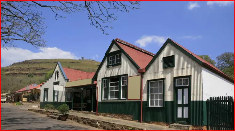
Once a booming gold rush town in the 1870s, Pilgrim’s Rest remains frozen in time. The entire town is a national monument, with original corrugated iron buildings, dusty streets, and historical landmarks that transport visitors to the gold mining days. Visitors can pan for gold, explore the Royal Hotel, or take a ghost tour to hear tales of fortune seekers who never left.
SAHO is free because readers fund it. Donate →
Affectionately known as ‘Magogo’ (meaning grandmother – a title bestowed to her for her motherly, nurturing character), Rebecca Makgomo Masilela (nee Kekana) was born on 12 December 1928 in Hammanskraal, north of Pretoria, Transvaal Province (now Gauteng), previously Farm 396, Leeuwkraal. Her father, Abraham Jambo Kekana, who was acting Chief of the Ndebele on three occasions until his death on 6 June 1964, bought Leeuwkraal on behalf of the Ndebele people and later renamed it Kekanastaad.
SAHO is free because readers fund it. Donate →
Renosterfontein is located in the region of Limpopo. Limpopo's capital Polokwane (Polokwane) is approximately 174 km / 108 mi away from Renosterfontein (as the crow flies). The distance from Rhenosterfontein to South Africa's capital, Pretoria (Pretoria) is approximately 135 km / 84 mi (as the crow flies). It falls under the Blue Crane Municipality's jurisdiction and in the Modimolle District. This could be one of the best fishing or outdoors adventure locations in the regions of Africa/Middle East.
SAHO is free because readers fund it. Donate →