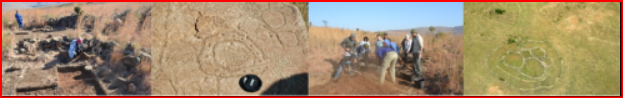
De Vlugt, Garden Route

De Vlugt is a small Settlement located Halfway through the Prins Albert Pass. It is the only Pass in South Africa, where People live beside the Road and Trade, within the Pass. The Town has a selection of quality and pretty Accommodation on offer, as well as Restaurants and Tea Gardens. The Area has a lot of fun activities on offer and visitors can find out more about these activities at the new Information Centre, opposite the Outeniqua Trout Lodge. There is however no Mobile Reception, Banks or Petrol, available on the Pass! It is Roughly halfway along Prince Alfred Pass (R 339), as it descends to meet the River, is the Historical Hamlet of; De Vlugt. Also know as Die Vlug, De Vlugt is what remains of the dwellings of Andrew Geddes Bain and his son, Thomas, their Outbuildings and the Concentration Camp that housed the 270 or so Convicts, who labored to Build the Pass, the early 1860's. Bain began his task on the Knysna side of the Pass, widening the tracks of elephant through the Forest, before setting up Camp Midway, in the Poort along the Banks of the Keurbooms River, to continue the demanding task of Pass Building.
Little has changed in De Vlugt since then. The only nod to Globalization is a Telkom Telephone, on one side of the Road, and a Tea Garden that offers coffee and melktert, bottled fruit, jams, tea, scones and hand-painted ornaments, on the other. Otherwise the peaceful Hamlet remains undisturbed, (a Small Settlement, generally one Smaller than a Village, and one without a Church!) In this Stretch of the Pass, life is about as slow as it is going to get off the beaten Track in South Africa. Baine's cottage still has original yellowwood floors, the kitchen a large Aga stove, and there is no electricity.
There are a couple of reasons to stay here:
#Burchell's Track, a 4X4 route that follows Burchell's ox wagon Trail through the Kloof; a real Pioneer track threw by William John Burchell, the Botanist, in the Hectares of fynbos to the West of De Vlugt. Burchell traveled from Skuurbeknek to Romanskraal, Jaggakamma and Knoetskraal before linking up with the Paardekop trail to Plettenberg Bay.
#It was only in 1998, when a fire destroyed Hectares of fynbos between Pietersrivier Farm and De Vlugt that the tracks made by his wagon were revealed. Burchell's Track is run by local; Katot Meyer, with the help of Middle Keurbooms Conservancy and Cape Nature.
#Look out for hand-painted maps of the Trail in the old Cottage, at De Vlugt, if you want to follow the Trail that Burchell carved with his wagon. Interestingly: he had the wheelbase deliberately narrowed to enable him to navigate the narrow sections, which makes it steering wheel-gripping at times!

Geolocation
23° 10' 44.4", -33° 49' 8.4"

De Rust, Little Karoo

The Little Karoo Village of De Rust, lying in the crook of a bend in the road somewhere between the Feather Capital of Oudtshoorn and the fold Mountains of Meiringspoort was once, a one-horse Town! Established in the 1900's. In recent Years, you’re more likely to find donkeys though in De Rust. Taking tourists for a ride around the Village for R 20 a throw. De Rust has won a ‘Small Town’ Awards, sells its stately Homes, at a 'goodly price' and welcomes all sorts of City, 'runaways'. The Locals are predominately Female, Coloured People, who speak Afrikaans!
If you’re looking for Artworks, De Rust is the kind of Country Village where Painters and Sculptors and Purveyors,(a person who sells or deals in particular goods, of fine furniture gather and display their wares).
Travelers on weekend breaks from Cape Town like to come as far as De Rust. Others arriving from the Hinterland on a trip to the Little Karoo, make the Village their first or last stop- As a result, all sorts of Restaurants and Accommodations, have sprung up to cater for the flow of Visitors.
And even though it’s so small, De Rust is a surprisingly convenient, Travel Base. From here you can do all manner of Day Trips to places like Prince Albert, Oudtshoorn, the Cango Caves, Klaarstroom and beyond.

Geolocation
22° 30' 32.4", -33° 29' 20.4"

De Doorns, Cape Winelands

De Doorns is a small Town, located in the Cape Winelands Region, of the Western Cape. Situated in the Hex River Valley, 32 km North-East of Worcester and 40 km south-west of Touwsrivier, on the Main Route to and from Cape Town, Johannesburg and Port Elizabeth The De Doorns Farm was bought by the Government of Cape Prime Minister John Molteno in 1875, to build a Railway Station for the expanding Cape Government Railways. The Line was built through De Doorns, connecting it to Cape Town and reaching Montagu Road (later Touws River). The Town would later develop around the Station! This is a Valley of Vineyards and snow-capped Mountains, during Winter that combine to make it one of the most picturesque Valleys, especially during Autumn when the different vines give rise to a wonderful display of various colours!
De Doorns is a town with a particularly impressive cultural heritage. In 1819 De Doorns was proclaimed a Sub-Drostdy of Tulbagh. Two Farms were bought for the purpose of laying out a Town. In 1822 De Doorns was proclaimed a full Drostdy. (In Historical Contexts this means: During the 17th, 18th, and early 19th Centuries, a Magisterial and Administrative District; Over which a Landdrost, had Jurisdiction).
De Doorns lies at the Centre of the Hex River Valley, in the midst of South Africa’s Table Grape Industry. This is a Valley of Vineyard upon Vineyard, Historical Cape Dutch Homesteads, and snow-capped Mountains during Winter that combine to make it one of the most picturesque Valleys, particularly during Autumn when the different vines give rise to a display of variegated colour, so rich, that all who see it are inspired and none left untouched by its beauty!
De Doorns Literally translated means ‘the thorns’ in Dutch, and refers to the Acacia Thorn Trees that dominate the Hex River banks. De Doorns’ Wine Cellar boasts the longest Harvest Season in the World, from December through until April. The Area exports nearly 17 Million Cartons, of grapes Annually!

Geolocation
19° 38' 52.8", -33° 28' 19.2"

Barrydale, Cape Overberg

The little Town of Barrydale lies nestled at the foot of the beautiful Langeberge in the heart of the Tradouw Valley, close to where the Northern exit of the Tradouw Pass winds through the Mountains to meet Route 62, the longest Wine Route in the World! Barrydale is one of those beautiful little Villages that beckon one to linger and has something too offer everyone! It lies on the Border between the Cape Overberg and the succulent Klein Karoo, which starts just North of the Town. It is no surprise to learn that Barrydale’s History began; when Farmers moved into the Valley to search for Fertile Land, with water. The Climate here is perfect for growing Fruit Trees: Apples; Pears; Oranges; Apricots; Figs; Peaches and Grape Orchards, lie scattered across the Valley. Any time of year, in this Valley is beautiful: Summer is ripe with fruit; Autumn heralds in the Protea Season; Winter is a tapestry of colour, as the surrounding Klein Karoo, renowned for its: Aloes; Milkbush; Concertina Plant and Succulents, which have broken into flower!
The little Village is also easily accessible. One can approach Barrydale from the Garden Route along the Tradouw Pass, from Montagu or from Oudtshoorn across the relentless plateau of the Klein Karoo - each of them beautiful and scenic. The Town’s cellars are set in their very own Region of Origin, the Tradouw Valley - the smallest in the Country - that produces incredible Brandies and Wines! Visit the Farm known as the Manger, in nearby Lemoenshoek to walk the Labyrinth and the Peace Pagoda; walk through Barrydale’s Heritage Garden; restore body and soul at the Warmwaterberg Hot Springs or hike in the surrounding Hills.

Geolocation
20° 42' 32.4", -33° 54' 32.4"

Gouda, Cape Winelands

Gouda is a little Village just 37 km South of Porterville, at the Western entrance to the Nuwekloof Pass that links Tulbagh to Wellington. "The Town does not produce or, in fact, have anything to do with Cheese. The only Gouda you will find here, is in the local Supermarket!"

But it does have some connection with Gouda, the Town after which it is named, in Holland. The story goes that originally Gouda was a Farm, known then as; 'La Bonne Esperance', owned by three Sisters who had Immigrated from Gouda, in Holland. They donated their Farm to establish a Town, on the provision that the Town, be named Gouda! There are others however, that believe that the name actually originates from the Khoi word meaning 'Antelope' or 'Honey Kloof'. Gouda was once the Rail Terminus, for Porterville, and another Branch Line fed from Porterville to Hermon. Gouda's Residents are predominantly Farmers and Seasonal Workers who work on the grape, peach and banana Farms in the District. Gouda has found itself back on the map by erecting, forty-six 3 MW Acciona Wind power Turbines. This is now known as; Gouda Wind Park. Not only do they supply 138 MW of power to the grid, but this is the first Wind farm to use Concrete Towers, as opposed to Steel. Wind Turbines work on a simple principle: instead of using electricity to make wind—like a fan—wind turbines use wind to make electricity. Wind turns the propeller-like blades of a turbine around a rotor, which spins a generator, which creates electricity. Due to this new Wind Turbine Farm, Gouda's Population has increased according to Census Readings, from 2 574 (2001) to 3 441 (2011).

Geolocation
-33° 17' 45.6", 19° 28.8"

Fetcani Pass, Eastern Cape

There are many Mountain Passes in the Highlands of the Eastern Cape and Fetcani Pass is no exception, functioning as a passage between other Mountain Passes. When you're on your way to Rhodes University and heading for the major gravel Passes in this mountainous part, of the Eastern Cape.

This is the first little Pass that gets you off the R 58 Main Route and into the remoter part of the Southern Drakensberg. (From here you won't see tar again for a long time!) The 5,7 km Long Pass, which is of moderate Length, has an equally moderate altitude variance, of 156 m. The steepest parts are at a 1:9 ratio and should present no problems for any type of Vehicle in fair Weather. However, with a Summit Altitude of 2088 m, this Pass is regularly smothered under a thick blanket of snow, and it's best avoided under those circumstances, (After heavy Rain, the Road is slippery, requiring 4 Wheel Drive)!

Fetcani Pass, begins a little after the Summit of the remarkable Barkley Pass, on the tarred R 58 Route out of Elliot. You will need to turn Right onto the gravel R 393 just after the Road passes, the Mountain Shadows Hotel, to find the start of the Pass, (roughly only about 1 km later.) Also known as the "Mfecane Pass", Fetcani Pass, doesn’t even measure on the Richter scale of Mountain Passes when compared to other Passes in the Vicinity, (the eight Passes of the Cape Highlands). Thereafter the Road, immediately descends steeply into the next Valley, continuing on its Westerly course. Before you know it, the Pass is over and the road turning to Bastervoetslaan Pass is just North of it. ( just a reminder that the area is 4X4 Country!) Bastervoetslaan is one of the most notorious Passes around Rhodes, and without exception this is a high clearance Pass, that needs expert navigation to complete. If you continue on the R393 you come too, Lundin’s Nek Pass! Which is on the Right-hand Fork to Rhodes University. Lundin’s Nek lies only 70 km after the Fetcani Pass.

The renewables energy programme, which is seen as an example for other African Countries, has resulted in over 6 000 MW of generation capacity being allocated to bidders across a variety of technologies, principally in wind and solar. Renewable Independent Power Producer Programme  (REIPPP) is aimed at bringing additional megawatts onto the country’s electricity system through private sector investment in wind, biomass and small hydro, among others. The Eastern Cape’s renewable energy projects has created 18 132 jobs since its inception. The Eastern Cape Province, was awarded 16 wind Farms and 1 solar energy Farm, with a total investment value of R33.7 Billion Rand.

Geolocation
-32° 21' 57.6", 26° 38' 20.4"

Skurweberg Pass, Mpumalanga

The Skurweberg Pass lies on the rim of the Drakensberg Escarpment - a steep, tarred and modern route over the Skurweberg Mountains, on the R 541 between Badplaas and Machadodorp. The aptly-named Skurweberg (“Rough Mountain”) Pass winds its way down the upper Drakensberg Escarpment between Machadodorp and Badplaas in Mpumalanga. The pass is much-loved by motorcyclists due to the curvy nature of the road, but it does have one or two corners which can be dangerous at high speed. It is relatively steep with an average gradient of 1:17 and descends a total of 448 metres, but the tarred road surface is good and free of potholes. Keep an eye out for monkeys and baboons, as well as domestic livestock. The pass can be driven in any vehicle and in all weather conditions!
Meaning 'rough mountain' in Afrikaans, the Skurweberg Mountains are a series of ancient Sandstone Outcrops; the remains of the seabed from the time of the bygone Super-Continent of Gondwana, at least 180 million Years old!
The Skurweberg is particularly beautiful – visitors travel the Pass not merely to get between Machadodorp and Badplaas, but to drink in the Views. In the Mountains is the Wathaba Wilderness Area, an area rich with Waterfalls, Streams, Pools and overgrown Kloofs. Filled with mosses, lichens, ferns and about 90 different Indigenous Trees.
The Pass starts in the South, just North of Badplaas, heading through a wide Kloof created by the flow of the Komati River. The initial Ascent is rigorous, gaining Altitude fast, as the road hugs the Mountain! On one of these sharp bends is the start of the Num-Num Trail, the core of which lies in the Skurweberg Mountains - five days of incredibly scenic Hiking, with a Slack packing option! A little farther on, and the gravel Road to the start of the Wathaba Hiking trail heads up the Eastern edge of the Kloof. From here the Pass straightens a bit, continuing to climb at a rapid rate! At the Summit is the 'Uitkomst Farm'.

Geolocation
30° 23' 9.6", -25° 48' 18"

Mariannhill, Pinetown

Mariannhill lies in a densely green, intense Landscape swept by Forests and sheltered, leafy Neighborhoods outside Durban, on the outskirts of Pinetown. The Monastery was founded by Trappist Monks in 1882, as a Catholic Mission and now boasts an impressive display of Architecture and Design. Beautiful Frescoes adorn the Cathedral ceiling and light streams through stained glass windows. In addition to this, the Monastery is well known for its Organic Produce including: milk, cheese and yoghurt. You can stop at the Monastery and enjoy a delicious lunch in their Tea Garden. The menu ranges from light snacks to heartier fare - sit in the shaded Garden and relax to the Monks chanting in the background. Despite being close to the Industrial parts of Westmead, the Monastery may as well lie Centuries, in the past. Enter its grounds and you are immediately transported out of the fast-paced World and constant nagging Elements of Modern Society.
A trip to the Gardens, Tea and Vegetable Gardens and Monastery, is a boost for the soul. The old Buildings, slowed pace and peaceful surrounds are without fail a balm to the soul, and one does not need to be here with Religious intent to benefit! Experience has produced, a choir of incredibly talented young Musicians was enough to establish the Mariannhill Monastery, as a cherished memory!
Mariannhill Monastery was Founded in 1882, by Trappist Monks who created an impressive collection of Architecture, Craftsmanship and Design. (Trappist Monks, are a contemplative Roman Catholic Religious Order; following the rule of St. Benedict, and a branch of the Cistercians). They speak only when necessary and idle talk is strongly discouraged – even meals are usually taken in contemplative silence whilst they listen to a reading. The silence is not a restriction however, but rather a wish to give space to what matters. There are thought to be around 170 Trappist Monasteries in the World. Which is Home to 2500 Trappist Monks and 1800 Trappist Nuns!
The Cathedral is a play of light, as rays of sun pierce stained glass windows and bounce from the ceilings filled with Frescoes. The interior invites a moment of two of silent contemplation, whatever your Spiritual Beliefs are!
Set in the midst of this embellished simplicity, is a Garden; where tables are artfully set in the shade of giant Umkhulu Trees. Every now and again there is the distant sound of; Gregorian Chants which are practically inaudible which suggest peace, rather than an intrusion! It also helps to sets the tone of the garden and inspires those who visit here. It’s a perfect little piece of Heaven, in which one just happens to also get a good meal! A range of enticing home-made food includes muffins, vegetarian meals or rye open sandwiches. Vegetables and salad comes from the Vegetable Garden,supplies fresh organic salad leaves and herbs not only to the tea garden at the monastery, but also to restaurants in and around Durban. the rye bread is baked by the Nuns, at the Jabulani Self-Help Scheme, who also produce plain brown bread for sale to the local community, and the milk and yogurt is from the monastery’s own, two Dairy's. The cheese is produced on the opposite side of the Valley from the milk, by the Sisters of the Precious Blood. Both are produced Organically and cows grace effortlessly on rather steep Hills. There are also a series of Workshops here where crafts, including candles, are produced.
The monastery has an interesting History. By all accounts Prior Franz Pfanner, who then became Abbot, and who led the order was incredibly strict and the vow of silence was held by all! But, as inevitably occurs when extremism is involved, an uprising led to his being suspended and a new order began, that went on to establish Missions Stations around the Country and the World. It was also very active in the fight against Apartheid, particularly with regards to the Group Areas Act. But it is the silence and the essential tranquility, that seems to be innate in every form and almost engulfs the surroundings! "This makes Mariannhill Monastery so incredible!" There are tours available; that includes lunch and many of the Buildings, the beautiful private Gardens, the Cathedral, Vestments, Church, and the Museum.

A Blog written about Mariannhill: "I’m looking at the incredible interior of the church of the Monastery of Mariannhill and realizing why, despite its being Years since last I was here, it had such a profound effect on me as a 16-year-old. During my third year of High School, I sang with a Choir that recorded Franz Schubert’s Mass no 2, in G whilst standing, within this sanctuary! It was one of the most intense experiences of my life. The sound we managed to evoke in this place of God was not only incredible, it was impressive and, as young people only beginning to form opinions and views on the World. I felt I had touched something within and without that I would endeavor to recreate again and again in my life."

Geolocation
30° 48' 36", -29° 50' 42"