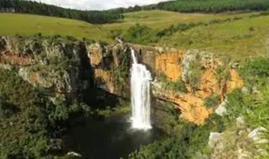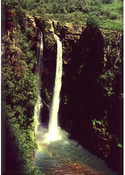
The Mac-mac falls is the second highest falls in the Mpumalanga tour route, its shimmering waters plunge to a depth of 65m. The Mac mac Falls is 13 km from Sabie on the R532 road towards Graskop. The turnoff and parking area is at the curio stalls and a nominal entrance fee is charged. A steep walk along a cement pathway (with many steps) takes you to the viewing platform above the falls. The 65 m high Mac mac Falls, in the Mac mac River is a declared National Monument. This waterfall was originally a single stream, but gold miners blasted it with dynamite to divert the river in an attempt to work the rich gold-bearing reef over which it plunges.
Place record
Mac-mac falls

Mac-mac falls Image source
- Coordinates
- 30.8140, -25.0050
- Updated
- 13 May 2021

Mac-mac falls Image source
Location Map
Mac-mac falls
How we know this
- 01https://www.sabie.co.za/gallery/mac-mac-falls.html
Last updated · 13 May 2021
South African History Online. (2011, July 14). Mac-mac falls. South African History Online. https://sahistory.org.za/xh/ref/P-0066070
South African History Online (2011) 'Mac-mac falls', South African History Online, 14 July. Available at: https://sahistory.org.za/xh/ref/P-0066070 (Accessed: 22 July 2026).
South African History Online, Mac-mac falls [website], https://sahistory.org.za/xh/ref/P-0066070, (accessed 22 July 2026).
"Mac-mac falls." South African History Online, 14 July 2011, https://sahistory.org.za/xh/ref/P-0066070. Accessed 22 July 2026.
South African History Online. "Mac-mac falls." South African History Online. July 14, 2011. https://sahistory.org.za/xh/ref/P-0066070.
Further reading
White River, Mpumalanga
Balule Private Game Reserve, Kruger National Park
Sabie Sands Game Reserve
Bejani, a tributary of the Sabie River in the North West
Ehlanzeni District Municipality
Graskop, Mpumalanga
SAHO is free because readers fund it. Donate →