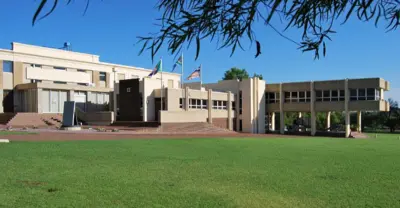
Founded in 1884, the Town was formed within an Area granted to early Voortrekker settlers, by the Zulu King Dinizulu. After Boers; Local farmers, had helped King Dinizulu defeat his rival chief Zibhebhu for succession of the Zulu throne. Land that they occupied was given to them by session from the Zulu king along the banks of the Mfolozi River. On August 5, 1884 the Boers formed the Nieuwe Republiek (New Republic) with Vryheid as its Capital and its sovereignty was recognized by Germany and Portugal. It was later incorporated into the South African Republic, but at the end of the Second Boer War; the Town and its surrounding Area was absorbed into the Natal colony by the British. Rich Coal Seams were discovered soon after and this, along with an expanding Agricultural Industry, ensured the rapid growth of the Town. The coal assets have mostly been depleted and this has shifted the Economic focus, to Tourism! Vryheid - from the Afrikaans word for ‘freedom’, also lies close to the Site of one of the more infamous battles, of the Battlefields Route. The town of Vryheid was moreover intrinsically involved in the subsequent Anglo-Boer War of 1899, making it one of the more interesting Towns on the Battlefields route. Whilst Vryheid’s surrounds are largely dominated by timber farming - hence the extensive wattle and timber plantations - crops such as groundnuts and maize, and mining, the Town also lies near the sources of four major Rivers: 'the White and Black Umfolozi, Mkhuze and Pongolo'. Access to Wetlands in the Area is thus good, and some of them are of regional importance, which is of added benefit to bird watchers and provides a diversity of scenery for hikers to the Area, coupled with the added value of several nature Reserves. There are several notable Buildings in the Town of Vryheid worth seeing, such as the Old Raadsaal (old council chambers), the Lucas Meyer House (he was president of the rather brief Nieuwe Republiek), and the Dutch Reformed Church. The Vryheid Nature Reserve, just outside Town that includes both one day and two day hikes, some small game and a bounteous bird life, and the Klipfontein Bird Sanctuary, two kilometres South West of the Town and part of one of the aforementioned Wetlands. One of the best kept secrets is the Ithala Game Reserve is a magnificent Reserve nearby, tumbling from the heights of the Ngotshe Mountains a thousand meters down into a deep Valley, carved over by the Phongolo River revealing the World`s oldest rock formations, is a game viewers paradise!
Place record
Vryheid, Northern KwaZulu-Natal
- Coordinates
- -27.7770, 30.7360
- Updated
- 20 Jul 2026
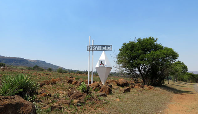
The Welcome Sign, Into Vryheid!
Location Map
Vryheid, Northern KwaZulu-Natal
How we know this
Last updated · 20 Jul 2026
South African History Online. (2021, April 8). Vryheid, Northern KwaZulu-Natal. South African History Online. https://sahistory.org.za/ref/P-0150789
South African History Online (2021) 'Vryheid, Northern KwaZulu-Natal', South African History Online, 8 April. Available at: https://sahistory.org.za/ref/P-0150789 (Accessed: 26 July 2026).
South African History Online, Vryheid, Northern KwaZulu-Natal [website], https://sahistory.org.za/ref/P-0150789, (accessed 26 July 2026).
"Vryheid, Northern KwaZulu-Natal." South African History Online, 8 Apr. 2021, https://sahistory.org.za/ref/P-0150789. Accessed 26 July 2026.
South African History Online. "Vryheid, Northern KwaZulu-Natal." South African History Online. April 8, 2021. https://sahistory.org.za/ref/P-0150789.
Further reading
 Article
The aftermath of the Battle of Blood River 1838
 Article
The Battle - Andries Pretorius and his men advance
 Article
Origins of the Battle of Blood River 1838
 Biography
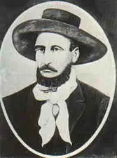
Piet Retief
 Place
Place
Anglo Boer War Museum, Bloemfontein

SAHO is free because readers fund it. Donate →