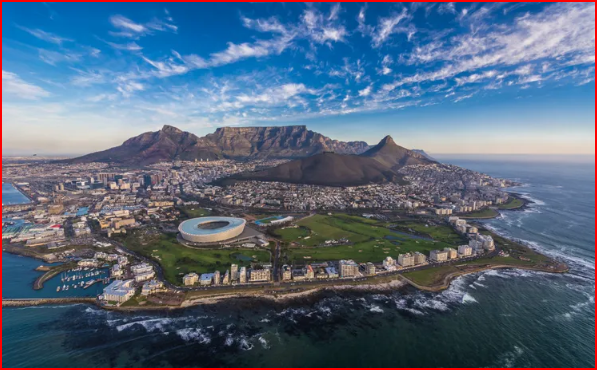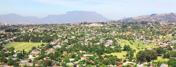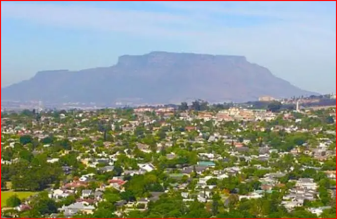
The main Areas within the Northern Suburbs of Cape Town include: Bellville; Durbanville; Parow; Goodwood; Brackenfell, and Kraaifontein. Along with Tygervalley; Plattekloof; Edgemead; Century City and Bothasig. These areas are generally located along or near the N1 freeway, extending North East from Cape Town.
Choosing between the Northern and Southern Suburbs of Cape Town depends on various factors including: 'personal preferences, lifestyle, and safety concerns'. There is a comprehensive breakdown of both areas in FURTHER READING. Ask any resident of Cape Town and the major distinction between the Northern and Southern Suburbs will be language. English-speaking people live in the South and Afrikaans-speaking people live in the North - "but this is a sweeping generalisation and doesn't take into account the obvious exceptions to the rule!" Suffice it to say that the newspaper of choice in the Northern Suburbs is ‘Die Burger', whilst ‘The Cape Argus' serves the Southern Suburbs. The informal boundary between the Northern and Southern Suburbs of Cape Town is often referred to as the "Boerewors Curtain".This is a playful term, not a formal geographical division, used to denote the cultural and linguistic differences between the two areas. While the N1 highway is sometimes cited as a physical border, the "Boerewors Curtain" is more about the perceived cultural divide, with the Northern Suburbs being predominantly Afrikaans-speaking and the Southern Suburbs more English-speaking
"The Liesbeek River is the River that primarily divides the Northern and Southern Suburbs, of Cape Town." This statement is however Geographically impossible! Whilst the Liesbeek River does flows through the Southern Suburbs, it does not form a clear boundary between the Northern and Southern Suburbs.The River's path is more of a Geographical feature, within the Southern Suburbs, themselves. The distinction between the two regions is more a matter of general location and, in some cases, cultural and language differences.--This is because the Liesbeek River runs through Rondebosch then it flows in a Northwards direction between Main Road and the Railway Line. The Black River also flows through Rondebosch, in a North Easterly direction through the Eastern part of the Suburb. The Story of the Liesbeek River: It is named after a small river in the Netherlands. Originally called the Amstel or Versse Rivier, it was the first River named by: 'Jan van Riebeeck'- commander of the Dutch Settlement, at the Cape. In 1657, shortly after the arrival of Dutch settlers, the Dutch East India Company granted Land along the Liesbeek to the first free burghers. These were former company employees who were allowed to Farm independently. Their Farms stretched along the River’s banks. This established one of the first Agricultural Zones at the Cape. The Liesbeek River is less than 9 km long. It flows through South Africa’s oldest urbanised River Valley. Its source is on the Eastern slopes of Table Mountain above Kirstenbosch Botanical Gardens. The upper catchment includes areas like; Bishopscourt- where large Residential Properties are located, including what was once Jan van Riebeeck’s Farm. In this Area, water is often diverted for irrigation, reducing its natural flow in Summer. Further downstream in Newlands, the River runs past smaller Residential Plots. South African Breweries and the Historic, Josephine Mill. Are both located here! From Rondebosch onwards, much of the River is canalised. Where the River is not canalised, at Observatory in the Southern Suburbs, below Rosebank and Mowbray, the Liesbeek joins the Black River. Urban Park lies between these Rivers and includes Heritage Sites and Public, open spaces. From here, the Black River flows into Table Bay at Paarden Eiland. --
The Liesbeek is also home to the African clawed frog, or Platanna, which has been used in various fields of medical research. (LINK IN FURTHER READING)