Philip Kgosana Drive, Devil's Peak Estate- Cape Town

The Road was originally named after Nicolaas de Waal, the first administrator of the Cape Province. He initiated the Road's construction. De Waal Drive is set against Table Mountain and is the main highway leading out of the City towards Cape Town International Airport and the Southern Suburbs. The popular De Waal Park, one of the City’s largest Public Parks and a Heritage Site, lies in the heart of the City. David de Waal established this Park in 1881, on condition that dogs must be able to run off leash in the Park. They still enjoy this freedom today!

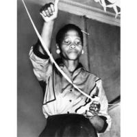
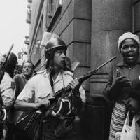
The proposal for renaming the Road came from Cape Times Editor, Tony Heard, who was present at the protest on March 30, 1960. This protest was led by Philip Kgosana, who was then, only 23 Years old! Thousands of people followed him from Langa to Parliament. Protestors marched about 12 km via De Waal Drive into the City to show their unhappiness following the Sharpeville Massacre. Kgosana was arrested and within a week. The Apartheid Government declared a State of the Nation Emergency and banned the African National Congress and the PAC. Driving their movements underground and into militarization. Kgosana died on April 19, 2017 aged 80 after a short illness. President Jacob Zuma declared a special Provincial funeral for the Veteran.

Geolocation
-33° 56' 2.5781", 18° 25' 39.0564"

History Classroom Grade 10 Topic 6: The South African War and Union

Contextual Overview

This topic investigates the ways in which the politics and culture of the Boer Republics clashed with the modernising thrust of the Uitlanders on the rapidly growing Reef in the late 19th century.  The topic ends with the Union settlement in 1910. The Union laid the foundation for white co-operation at the expense of black South Africans (in terms of franchise and land). It resulted in the consolidation of white rule, and thereby paved the way for a system of racial capitalism. The Land Act was the precursor to Apartheid land settlement, which resulted in forced removals, with their social and economic consequences.


Thaba Bosiu, Lesotho

Thaba Bosiu is a sandstone Plateau, at the historic and spiritual heart of the Sotho Kingdom, in Lesotho. Rising to an altitude of 1,800m only 20km East of Maseru, this near-impregnable sandstone plateau served as the residence and military stronghold of Moshoeshoe I, the kingdom’s founding father, throughout most of his mid-19th Century reign. Sotho oral tradition has it that Thaba Bosiu - literally ‘Mountain of Night’ - was so named by Moshoeshoe because he and his followers, who arrived there in the chilly midwinter of 1824, made the initial ascent to the plateau after dark. The name also alludes to the belief that the Mountain grows taller at night, a legend propagated by Moshoeshoe to discourage his enemies from attempting a nocturnal siege. The expansive flat-topped summit is protected on all sides by formidable sandstone Cliffs, yet it is watered by half a dozen natural Springs and was large enough to hold plenty of livestock.
Thaba Bosiu is steeped in history. From the Visitor’s Centre at the Mountain’s base, a steep and gravelly footpath follows Khebelu Pass to the Plateau. The Plateau also offers superb views in all directions, the most conspicuous landmark from the summit being Mount Qiloane, a conical sandstone pillar that stands about 1km to the east and whose distinctive shape reputedly inspired the design of the traditional Basotho mokorotlo straw hat.


Mount QiloaneImage Source

Adjacent to the Visitor’s Centre at the Mountain’s base, Thaba Bosiu Cultural Village is an architecturally innovative complex that provides a modern spin on traditional Sotho stone-and-thatch building techniques. In addition to a Hotel and Restaurant, it incorporates a replica Sotho Village of traditional Homesteads, and an informative Museum dedicated to Moshoeshoe I and various aspects of traditional Sotho culture.

Although plenty of Hotels and guesthouses are available in Maseru about 20km to the West, the stone-and-thatch chalets at Thaba Bosiu Cultural Village might be more attractive to those who prefer a more rural setting. An international Restaurant with thatch roof and terrace seating can be found at Thaba Bosiu Cultural Village almost alongside the Visitor’s Centre. Thaba Bosiu is about 30-45 minutes’ drive East of central Maseru along the surfaced A2 and B2. It lies a similar distance North East of Moshoeshoe, International Airport. Regular public transport runs there from Maseru.
Solid walking shoes are recommended for the short but steep and gravelly hike to the plateau. A walking stick might also be useful!

Geolocation
27° 37' 51.6", -29° 20' 56.4"