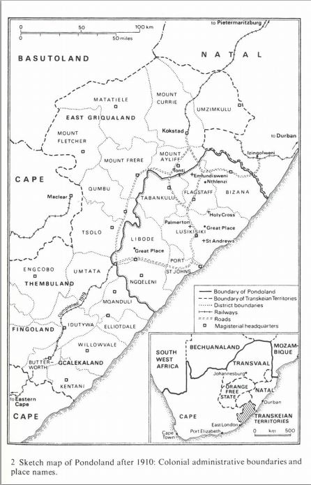
Published 13 January 2014Updated 26 August 2019Cite This PageShareSketch map of Pondoland after 1910: Colonial admisnistrative bounderies and place names