14 records
 Maps
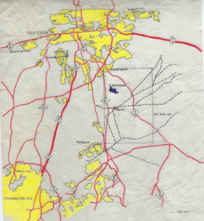
MapsPower stations operation, 21 July 1981, Apollo Location map, 1
 Maps
MapsBlack Consciousness
Background to the Black Consciousness Movement and an overview of the development of the South African Students Organisation (SASO)…
Maps
Sketch map of Pondoland after 1910: Colonial administrative boundaries and place names
Sketch map of Pondoland after 1910: Colonial admisnistrative bounderies and place names
Maps
The Free Burgher Settlement at the Cape
View in Full Size
Maps
Map of South Africa pre-1994, with Bantustans
Maps
Map of South Africa post 1994
Maps
Map Johannesburg - Population Density by Race
Maps
Map of The Cape Colony 1656 with Legend
View in Full Size
Maps
Map Cape Town - Popolation Density by race
Maps
Sketch map of locations in the Lusikisiki district for the identification of place of residence of oral informants
Maps
Map Pretoria - Population Density by race
Maps
Sketch map of Pondoland and the Transkeian Territories in the 1880s
Maps
South Africa 1977
Maps