
The Village of Cofimvaba was probably established in about 1877 when the Magisterial seat for Tembuland, which had originally been located to St Marks, which has subsequently, been transferred to a more accessible location. It derives its name from the Xhosa words "cofa", meaning to froth, and "mvaba", a goatskin bag for milk. This is the name of a nearby river which, after a heavy rainfall, is said to become swollen and frothy like a milk-bag.
placeREF P-0013752Revised
Place record
Cofimvaba, Eastern Cape
- Coordinates
- -32.0020, 27.5810
- Updated
- 17 Dec 2025

The Cofimvaba Village
Location Map
Cofimvaba, Eastern Cape
South African History Online. (2011, March 16). Cofimvaba, Eastern Cape. South African History Online. https://sahistory.org.za/xh/ref/P-0013752
South African History Online (2011) 'Cofimvaba, Eastern Cape', South African History Online, 16 March. Available at: https://sahistory.org.za/xh/ref/P-0013752 (Accessed: 22 July 2026).
South African History Online, Cofimvaba, Eastern Cape [website], https://sahistory.org.za/xh/ref/P-0013752, (accessed 22 July 2026).
"Cofimvaba, Eastern Cape." South African History Online, 16 Mar. 2011, https://sahistory.org.za/xh/ref/P-0013752. Accessed 22 July 2026.
South African History Online. "Cofimvaba, Eastern Cape." South African History Online. March 16, 2011. https://sahistory.org.za/xh/ref/P-0013752.
Further reading
 Place
Place
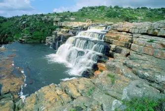
Butterworth, Wild Coast
Butterworth is situated in the Eastern Cape of South Africa and is one of the oldest towns in the Eastern Cape's Wild...
 Place
Place
Xumabokwe Hill, Queenstown
The Hill is 1 535 Metres high and is found 26 Kilometres from Lady Frere. The name is said to mean 'jump for joy hill',....
 Place
Place
Sidwadweni Village, Queenstown-Eastern Cape
Sidwadweni is a little village with about a 150 people for its population, in the Eastern Cape which has produced a...
 Place
Place
Elliot, Thembuland
The Village of Slang Rivier was founded early in 1885, and in April 1894 its name was changed to Elliot, after Sir...
 Article
Xhosa
The four major ethnic divisions among Black South Africans are the Nguni, Sotho, Shangaan-Tsonga and Venda.
SAHO is free because readers fund it. Donate →