
Place record
Mogwase, Bojanala Region
- Coordinates
- -25.2680, 27.1720
- Updated
- 5 May 2022
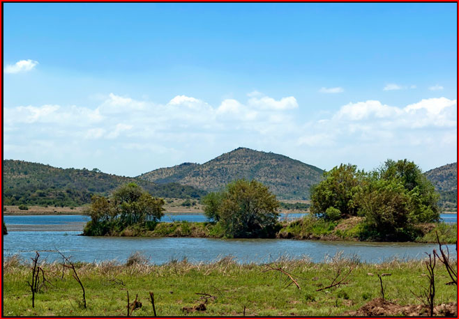
Mankwe Dam- is the biggest body of water in the Pilanesberg National Park. Built by the farmers who originally owned the land, before it was incorporated into the reserve, it looks more like a lake than a dam.
Location Map
Mogwase, Bojanala Region
How we know this
- 01https://bojanala.gov.za/ https://local.infobel.co.za/ZA100794316-0145555630/mogwase_correctional_centre-sunrise_park.html
Last updated · 5 May 2022
South African History Online. (2022, May 5). Mogwase, Bojanala Region. South African History Online. https://sahistory.org.za/ve/ref/P-0151607
South African History Online (2022) 'Mogwase, Bojanala Region', South African History Online, 5 May. Available at: https://sahistory.org.za/ve/ref/P-0151607 (Accessed: 22 July 2026).
South African History Online, Mogwase, Bojanala Region [website], https://sahistory.org.za/ve/ref/P-0151607, (accessed 22 July 2026).
"Mogwase, Bojanala Region." South African History Online, 5 May 2022, https://sahistory.org.za/ve/ref/P-0151607. Accessed 22 July 2026.
South African History Online. "Mogwase, Bojanala Region." South African History Online. May 5, 2022. https://sahistory.org.za/ve/ref/P-0151607.
Further reading
 Place
Place
Pilanesberg Game Reserve
 Place
Place
Sun City, Rustenburg
 Article
2014 South African platinum strike: longest wage strike in South Africa
 Place
Place
'Boekenhout' Farm in Rustenberg
 Article
Tswana
SAHO is free because readers fund it. Donate →