Skip to main content
South African
History Online
Politics & Society
Africa
Art & Culture
Biographies
Classroom
Places
Timelines
Archives
About Us
Cite This Page
Share
Print
Timeline Explorer
♥
Donate
South African History Online
Know your
history
Search SAHO
30,000+
Archive records
17,000+
Historical events
10,000+
Biographies
2,800+
Articles
Trending topics
Apartheid
Nelson Mandela
Freedom Charter
Sharpeville
Steve Biko
Anglo-Boer War
Mandela
Zulu
Browse by era
Pre-colonial
Colonial era
Apartheid era
Liberation struggle
Post-1994
World Wars
Explore by type
Politics & Society
Biographies
Timeline
Archives
Classroom
Recent searches
Menu
Politics & Society
Africa
Art & Culture
Biographies
Classroom
Places
Timelines
Archives
About Us
Home
East Africa
Latest Articles
Ethiopia
Sort by
Changed
Order
Asc
Desc
Browse Content
Archives
Collections
Place
Britstown, Northern Cape
4 August 2020
Britstown located in the Northern Cape of South Africa, a small farming town Named after Hans Brits, who accompanied Dav...
Place
Bethelsdorp, Algoa Bay -Eastern Cape
31 July 2020
The Van der Kemp Memorial Church is still very much the spiritual centre of Bethelsdorp. Nearby are the almshouses, buil...
Place
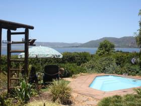
Belvidere, Knysna
31 July 2020
Captain Thomas Henry Duthie emigrated to the Cape in 1826. In 1830 he visited Knysna, where he was the guest of George R...
Place
Bejani, a tributary of the Sabie River in the North West
31 July 2020
The Bejani is a tributary of the Sabie River, entering from the North-West. Mkhohlu Railway Siding some 20 km South-East...
Place
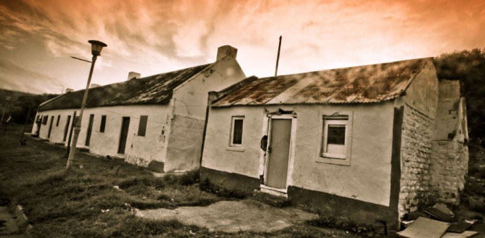
Beestekraal, North West
31 July 2020
Settlement with a Railway Station and Post Office, North of Brits. It was given the name in 1837 by the Voortrekkers und...
Article
A history of Indians in South Africa Timeline: 1654-2008
29 July 2020
This is a collection of timelines of Indians in South Africa from 1654 until 2008.
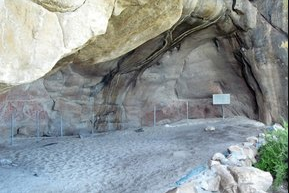
Place
Elands Bay Cave
29 July 2020
Hidden in the caves are the most beautiful cave paintings. These were done by the Bushmen who lived in this area thousan...
Place
Maluti-a-Phofung Municipality, Free State
27 July 2020
It is bordered by Phumelela in the North, the Kingdom of Lesotho in the South, the KwaZulu-Natal Province in the East, a...
Place
Sedibeng District Municipality
27 July 2020
The Sedibeng District Municipality is a Category C municipality situated on the Southern tip of the Gauteng Province and...
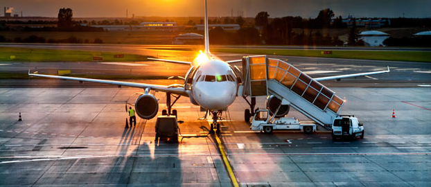
Place
Richards Bay Airport, Northern Kwa Zulu Natal
16 July 2020
This is a Municipal airport established in 1975. It has since the Year 2000 been managed by the Richards Bay Airport Com...
Place
Kruger Mpumalanga International Airport, Nelspruit
16 July 2020
An Airport located in Mbombela (Nelspruit), this is the gateway to the World’s most iconic Game Reserve, the Kruger Nati...
Place
Mthatha Airport, Eastern Cape
16 July 2020
Mthatha Airport serves the charming Town of Mthatha (affectionately known as Madiba Country) in the Eastern Cape Provinc...
Article
Indian South Africans timeline 2000s
13 July 2020
Indian South Africans Timeline: 2000 2008 16 November, Billy Nair is given a given a state funeral in Durban, a testam...
Article
Indian South Africans timeline 1990-1999
13 July 2020
Indian South Africans Timeline: 1990-1999 1990 23 July, Billy Nair was detained following police allegations of an uMk...
Article
Indian South Africans timeline 1980-1989
13 July 2020
Indian South Africans Timeline: 1980-1989 1980 Kay Moonsamy was sent to India to replace Mosie Moolla, as the African ...
Article
Indian South Africans timeline 1970-1979
13 July 2020
Indian South Africans Timeline: 1970-1979 1970 HA Naidoo passes away while still in exile. 17 February, African Peopl...
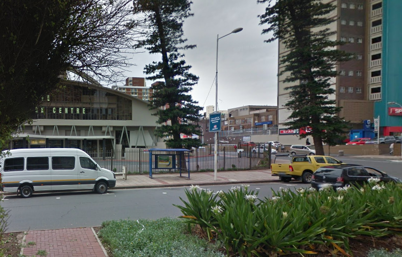
Place
Olive Convention Centre, Durban
13 July 2020
The Olive Convention Centre has become a firm favorite in the Conferencing and Events arena, largely due to its placemen...
Place
Mthatha, Eastern Cape- previously known as Umtata
8 July 2020
Umtata, founded in 1879, was declared the capital of the Transkei, the homeland of the Xhosa during the Apartheid era. T...
Place
Makhandra Aerodrome, Grahamstown
8 July 2020
Grahamstown has a small Airport. There are two larger Airports located in close proximity to Grahamstown. The closest is...
Place
Kimberley Airport
8 July 2020
Kimberley Airport based in The Northern Cape provides regular domestic flights in South Africa between Cape Town Airport...
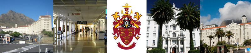
Place
Groote Schuur Hospital, Cape Town
1 July 2020
Groote Schuur is one of Cape Town's premier tertiary Academic Hospitals and was officially opened in 1938. The hospital ...
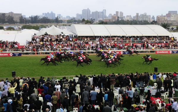
Place
Greyville Racecourse and Convention Centre, Durban
30 June 2020
The History of Greyville dates as far back as 1844, when it hosted the Province’s first official Horse Racing Event. The...
Place
Cyril Ceoghegan Cycling Track, Durban
29 June 2020
The track is named after champion cyclist and ex SACF (South African Cycling Federation) president, Cyril Geoghegan. It ...
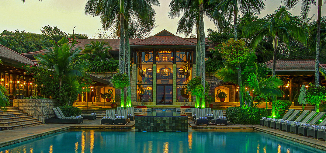
Place
Zimbali Coastal Resort, Ballito
25 June 2020
Zimbali Coastal Resort is a place where miles of deserted Beaches divide the warm Indian Ocean and the lush Coastal Vege...
Place
Bloemfontein Technical College, Douglas Street, Bloemfontein
17 June 2020
Also known as the Old Grey College building. The structure was designed by Architect WH Stucke and was erected in 1894-9...
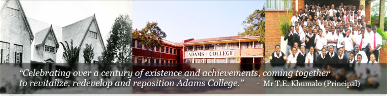
Place
Adams College, Amanzimtoti
17 June 2020
Adams College is a public school situated in Adams Mission which is 8 km inland from Amanzimtoti and 35 km south of Durb...
Place
Grey College Complex, Bloemfontein
17 June 2020
The main Grey College Building was designed by Architect WH Stucke, and its cornerstone was laid by President Reitz on 1...
Place
Appelkooskop, Ficksburg; free State
15 June 2020
Mountain North of Ficksburg. Afrikaans for 'apricot hillock' referring to the wild apricots that grow there. Used to be ...
Place
Apollo Peak, a Mountain Peak of Cederberg; Near Citrusdal
15 June 2020
Peak in the Cederberg range, 18 km North-East of Citrusdal. In Greek Mythology this means one who brings back the sunshi...
Place
Apiesrivier, a River Which Flows Through Pretoria
15 June 2020
River which has its source in the Fountains Valley and flows through Pretoria. Said to have been named after the large p...
First page
« First
Previous page
‹‹
…
Page
31
Page
32
Page
33
Page
34
Current page
35
Page
36
Page
37
Page
38
Page
39
…
Next page
››
Last page
Last »