With its pristine Coastlines, where the Atlantic and Indian oceans meet at the Southern-most tip of Africa. With its headquarters in Bredasdorp, the Overberg District Municipality is a category C Municipality governing the four local Municipalities of Cape Agulhas, Overstrand, Swellendam and Theewaterskloof.
The Municipal Area covers 12,241 km2 and currently has an estimated population of 300,285 people in 86,716 households. (This is according to a survey done in 2020. The link is in FURTHER READING.)
The Overberg is a Region in South Africa, to the East of Cape Town, is beyond the Hottentots-Holland Mountains. The name is derived from: 'Over the Berg', which means: "over the (Hottentots-Holland) Mountain". It lies along the Western Cape Province's South coast between the Cape Peninsula and the Region known as the Garden Route, in the East. The boundaries of the Overberg are the Hottentots-Holland Mountains in the West; the Riviersonderend Mountains in the North; the Atlantic and Indian Oceans in the South and the Breede River in the East.
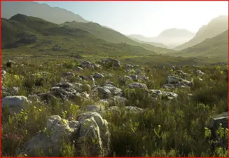
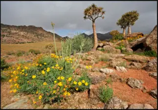
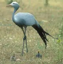
The Overberg has always been considered as the breadbasket of the Cape and is largely given to grain farming, mainly wheat. The wheat fields are a major breeding ground for South Africa's National bird; the 'Blue Crane'. Another important food farmed in the Overberg is fruit. Grabouw, being the second largest supplier of fruit in South Africa. Nestled in the Overberg, one can find the Kogelberg Biosphere Reserve, (which is recognised and registered with UNESCO). Populated with a large diversity of flowering plants not found anywhere else in the; 'Fynbos Biome'.
Kogelberg Biosphere Reserve was the first South African Biosphere Reserve. This Biosphere Reserve was established to preserve the biological diversity, of a particular Region in the World. These Reserves protect the plants, animals, natives and overall environment of the Area. They also help in conserving the lifestyle of plants and animals, that are conserved in it. It covers 103,629 hectares, more than 80% of which consists of Mountainous landscape ranging from high Mountain Peaks and deep Valleys to gentle Hills and lower Mountain slopes. The remaining area comprises a gently rolling coastal plain and a marine area, which covers about 24,500 hectares. The coastline is mostly rocky with sandy Beaches and Estuaries. The main economic activities in the Area are: apple farming and commercial pine plantations.
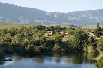
Tourism, specifically Eco-Tourism, has the potential to become a major Economic activity, (with some 60,000 people visiting the Area during the holiday season!) The major Towns are Hermanus, Caledon, Bredasdorp, Grabouw and Swellendam and the Region includes Cape Agulhas, the Southern most point of Africa. The landscape is dominated by gently to moderate Hills enclosed by; Mountains and the Ocean.