
Xhosa name for the Debe Hollows of Kommetjie Flats, 19 km West of King William's Town. This was the scene, of the Battle of Amalinda between Gaika and Ndlambe, in October 1818. The long standing rivalry between the senior Chief of Xhosaland, Ngqika, and his uncle, Ndlambe, erupted in a battle of epic proportions that was to go down in Xhosa tradition as the battle of Amalinde. This exceptional battle lasted from midday to nightfall, and was fought with such unusual ferocity that it takes a special place in the history of Xhosa warfare.The exact site of the battle of Amalinde remains uncertain. It seems unlikely to have been literally on the Amalinde. The old isiXhosa word, i-linde or umlinde, means 'grave mound and/or furrow', hence the descriptive name, Amalinde, used to describe many of them. No armed force would willingly choose to fight in veld covered by these features. The Amalinde mounds are up to a metre in height and the hollows between them are inconsistent in depth and size, too large to jump over. There is no level ground anywhere. The mounds are also usually covered by worm casts up to 10cm high with a mass of anything up to 800g. The Amalinde mounds and hollows are formed by the activity of giant earthworms (Microcheatis) in the waterlogged conditions occurring there during wet weather. Using their enormous casts, these large worms build up these mounds and retreat into them to avoid becoming soaked. The sodden conditions occur as a result of an impervious underlying rock layer which is also resistant to subaerial erosion. Men running barefooted over these micro landforms could only do so with the greatest of difficulty, so fighting here would not be by choice. And, yet, the evidence suggests that this terrain over which the battle of Amalinde was fought had indeed been chosen in advance. Ndlambe's strategy was that he reputedly stationed his young and inexperienced warriors in the open to serve as bait to draw out his arch-rival, Ngqika. His older and more experienced warriors were hidden and only came into action later after Ngqika's force was scattered and tired after the first encounters with the young warriors!
Place record
AmaLinde, West of King Williams Town
- Coordinates
- 27.4350, -32.9480
- Updated
- 19 May 2020

Ordering Xhosa Men to Battle!
Location Map
AmaLinde, West of King Williams Town
How we know this
- 01New Dictionary of South African Names by Peter E Raper https://samilitaryhistory.org/vol135hk.html
Last updated · 19 May 2020
South African History Online. (2016, September 20). AmaLinde, West of King Williams Town. South African History Online. https://sahistory.org.za/nso/ref/P-0121943
South African History Online (2016) 'AmaLinde, West of King Williams Town', South African History Online, 20 September. Available at: https://sahistory.org.za/nso/ref/P-0121943 (Accessed: 21 July 2026).
South African History Online, AmaLinde, West of King Williams Town [website], https://sahistory.org.za/nso/ref/P-0121943, (accessed 21 July 2026).
"AmaLinde, West of King Williams Town." South African History Online, 20 Sept. 2016, https://sahistory.org.za/nso/ref/P-0121943. Accessed 21 July 2026.
South African History Online. "AmaLinde, West of King Williams Town." South African History Online. September 20, 2016. https://sahistory.org.za/nso/ref/P-0121943.
Further reading
 Article
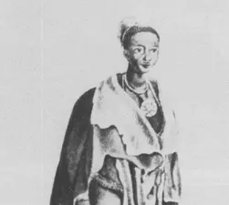
The Contentious Relationship Between Ngqika And Ndlambe
 Place
Place
Hobeni
 Place
Place
Shangana Cultural Village
 Place
Place
Transkei
 Place
Place
Bisho, Capital of the Eastern Cape
 Place
Place
King Williams Town, Amatola
SAHO is free because readers fund it. Donate →