
Railway Station 14km South-East of Stuterheim on route to Kei Road. The name is of Xhosa origin and refers to the AmaBhele clan.
placeREF P-0121939Revised
Place record
AMabele, Eastern Cape Railway Station

Amabhele, Xhosa Men
- Coordinates
- 27.1800, -32.2300
- Updated
- 18 May 2020
Amabhele, Xhosa Men
Location Map
AMabele, Eastern Cape Railway Station
How we know this
- 01New Dictionary of South African Names by Peter E Raper
Last updated · 18 May 2020
South African History Online. (2016, September 20). AMabele, Eastern Cape Railway Station. South African History Online. https://sahistory.org.za/nso/ref/P-0121939
South African History Online (2016) 'AMabele, Eastern Cape Railway Station', South African History Online, 20 September. Available at: https://sahistory.org.za/nso/ref/P-0121939 (Accessed: 22 July 2026).
South African History Online, AMabele, Eastern Cape Railway Station [website], https://sahistory.org.za/nso/ref/P-0121939, (accessed 22 July 2026).
"AMabele, Eastern Cape Railway Station." South African History Online, 20 Sept. 2016, https://sahistory.org.za/nso/ref/P-0121939. Accessed 22 July 2026.
South African History Online. "AMabele, Eastern Cape Railway Station." South African History Online. September 20, 2016. https://sahistory.org.za/nso/ref/P-0121939.
Further reading
 Article
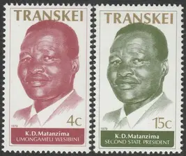
The Transkei
Struggles against the Bantu Authorities Act were fought in the Transkei, where the resistance of the peasants...
 Archive



SAHO is free because readers fund it. Donate →