
Pass about 40 km North of Witbank, leading Westwards from the Olifants River Valley to Wildehondekraal. The name is Afrikaans for 'off-saddle neck',( Pass at which saddle is removed!)
placeREF P-0121860Revised
Place record
Afsaalnek, Mpumalanga
- Coordinates
- -25.5699, 29.5597
- Updated
- 21 Apr 2020
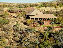
Bushveld with Loskop Dam In Distance
Location Map
Afsaalnek, Mpumalanga
How we know this
- 01New Dictionary of South African Place Names by Peter E Raper
Last updated · 21 Apr 2020
South African History Online. (2016, September 16). Afsaalnek, Mpumalanga. South African History Online. https://sahistory.org.za/nso/ref/P-0121860
South African History Online (2016) 'Afsaalnek, Mpumalanga', South African History Online, 16 September. Available at: https://sahistory.org.za/nso/ref/P-0121860 (Accessed: 22 July 2026).
South African History Online, Afsaalnek, Mpumalanga [website], https://sahistory.org.za/nso/ref/P-0121860, (accessed 22 July 2026).
"Afsaalnek, Mpumalanga." South African History Online, 16 Sept. 2016, https://sahistory.org.za/nso/ref/P-0121860. Accessed 22 July 2026.
South African History Online. "Afsaalnek, Mpumalanga." South African History Online. September 16, 2016. https://sahistory.org.za/nso/ref/P-0121860.
Further reading
 Place
Place
Witbank, Mpumalanga
eMalahleni, formerly Witbank, in the Mpumalanga Province, East of Pretoria. Established in 1890 as Witbank, it is at...
 Place
Place
Kruger National Park
The Kruger National Park was proclaimed on 31 May 1926 under the newly formed National Parks Board of Trustees, which...
 Place
Place
Wakkerstroom
"Nestled in the rolling hills and tranquil Valleys of South Africa’s Mpumalanga Province, Wakkerstroom is a hidden...
 Place
Place
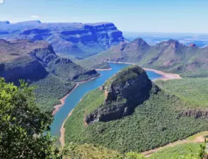
Blyde River Canyon, Mpumalanga
One of the largest green canyons in the world, the Blyde River Canyon is a masterpiece carved over millions of years by....
 Place
Place
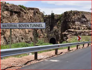
Emgwenya, formally Waterval Boven
Emgwenya means: 'Place of the Crocodile'. (Ngwenya, is an Nguni surname, meaning the same thing!) Emgwenya was formally....
 Place
Place
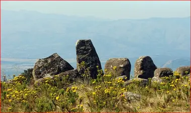
ADAMS CALENDAR also known as: 'Blaauwboschkraal Stone Ruins'
Interwoven in the Hills near Machadodorp in South Africa’s: 'Mpumalanga Province'.
SAHO is free because readers fund it. Donate →