Skip to main content
Skip to main content
South African
History Online
Politics & Society
Africa
Art & Culture
Biographies
Classroom
Places
Timelines
Archives
About Us
Cite This Page
Share
Print
Timeline Explorer
♥
Donate
South African History Online
Know your
history
Search SAHO
30,000+
Archive records
17,000+
Historical events
10,000+
Biographies
2,800+
Articles
Trending topics
Apartheid
Nelson Mandela
Freedom Charter
Sharpeville
Steve Biko
Anglo-Boer War
Mandela
Zulu
Browse by era
Pre-colonial
Colonial era
Apartheid era
Liberation struggle
Post-1994
World Wars
Explore by type
Politics & Society
Biographies
Timeline
Archives
Classroom
Recent searches
Menu
Politics & Society
Africa
Art & Culture
Biographies
Classroom
Places
Timelines
Archives
About Us
Home
District Six Gallery
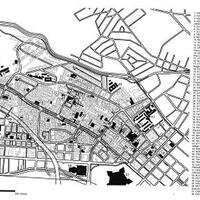
Map of District Six
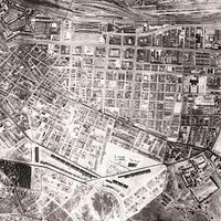
Historical aerial photo District Six
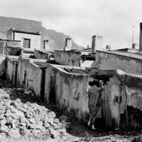
Woman and child, District Six
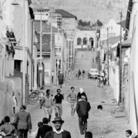
Richmond Street, District Six
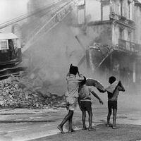
Boys watching destruction of District Six, South Africa, 1974
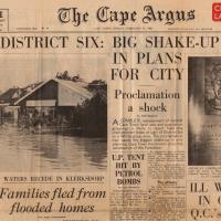
Cape Argus front page 11 February 1966
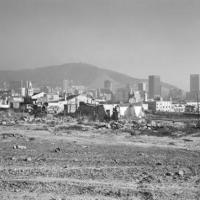
The destruction of District Six under the Group Areas Act. Cape Town, Cape. 5 May 1982
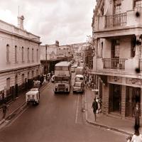
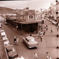
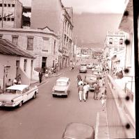
District Six, Hanover Street
District Six 1950s
District Six, the Fish Market
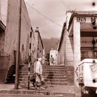
District Six, looking up Hanover Street with Tennant Street going right
District Six looking up Tennant street
Current page
1
Page
2
Next page
››
Last page
Last »
Return to article
District Six is Declared a ‘White Area’
Return to article
Land: dispossession, resistance and restitution