
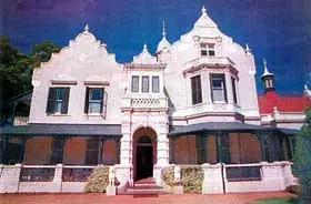
The village of Rhodes lies on the banks of the Bell River at the foot of the Witteberge. It was laid out on the farm Tintern, and was proclaimed on 16 September 1891. The village was named after Cecil John Rhodes, then Prime Minister of the Cape Colony. Records of a public meeting held there on 24 February 1892 indicate that it must have been known by this name from the onset. Despite this the local Dutch Reformed Church (DRC) congregation was, and still is, known as Rossville. The 1904 census indicated that Rhodes had a population of 432. On 11 November 1899 a party of Boers occupied the village during the Second Anglo Boer War. On 2 December 1899 they were joined by a second group under General J H Olivier. On 23 June 1901 Boer forces under Commandant Fouche returned to Rhodes and remained in occupation for two days before moving on.
Place record
Rhodes
- Coordinates
- -30.7972, 27.9600
- Updated
- 21 Jul 2026
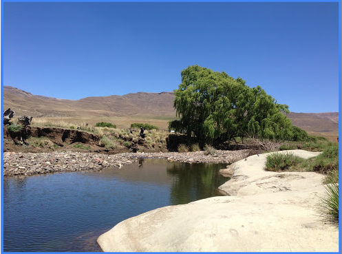
Rhodes, Village Image source
Location Map
Rhodes
How we know this
- 01By Franco Frescura
Last updated · 21 Jul 2026
South African History Online. (2011, March 16). Rhodes. South African History Online. https://sahistory.org.za/xh/ref/P-0013797
South African History Online (2011) 'Rhodes', South African History Online, 16 March. Available at: https://sahistory.org.za/xh/ref/P-0013797 (Accessed: 22 July 2026).
South African History Online, Rhodes [website], https://sahistory.org.za/xh/ref/P-0013797, (accessed 22 July 2026).
"Rhodes." South African History Online, 16 Mar. 2011, https://sahistory.org.za/xh/ref/P-0013797. Accessed 22 July 2026.
South African History Online. "Rhodes." South African History Online. March 16, 2011. https://sahistory.org.za/xh/ref/P-0013797.
Further reading
 Article
Women and Children in White Concentration Camps during the Anglo-Boer War, 1900-1902
 Article
First Anglo Boer War
 Article
The Jameson Raid
 Article
The Aftermath of the war
 Article
Role of Black people in the South African War
 Article
Black Concentration Camps during the Second Anglo-Boer War, 1900-1902
SAHO is free because readers fund it. Donate →