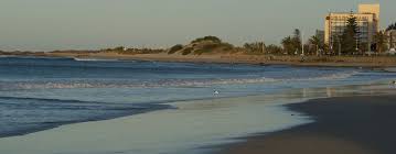
Uitenhage, officially renamed Kariega, is an industrial town in South Africa's, Eastern Cape Province. Which is situated within the Nelson Mandela Bay Metropolitan Municipality along the Kariega River, approximately 35 kilometres north of Gqeberha (formerly Port Elizabeth).
In Uitenhage you can still find buildings from the 1800's in their original form. The Old Drostdy Museum built in 1809 is now the home of the Uitenhage Africana Museum. It is the ideal setting through which to experience the history of Uitenhage. The Old Railway Station built in 1875 which is reputed as one of the oldest railway stations in South Africa is another historical attraction found in Uitenhage. Vintage locomotives, a variety of coaches and period furniture and equipment are on display in this museum.
The Cuyler Manor Museum is a living museum that arranges demonstrations of traditional activities like soap and candle-making, baking and weaving.
The Groendal Wilderness Reserve is also situated in Uitenhage. The reserve is the perfect place to go on a hike or have a picnic while listening to the birds singing.
Known as the Garden Town, Uitenhage was first a farming community on the banks of the Swartkops River. Now it is a thriving commercial and industrial town but has managed to keep its picturesque beauty.
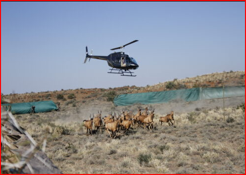
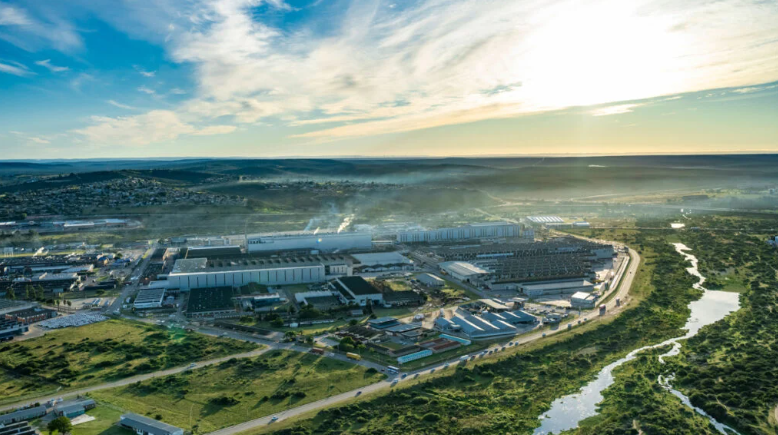
Volkswagen Factory the biggest car factory on the African continent is located here in the Nelson Mandela Metropolitan Municipality.
In 1804, Commissioner-General Jacob Uitenhage de Mist undertook an extended survey of the border regions of the Cape. As a result of this he put forward a number of proposals aimed at improving colonial administration over these areas. One such involved the separation of the eastern regions, then falling under Swellendam and Graaff-Reinet, and their consolidation into a new administrative district. This proposal was accepted and on 25 April 1804 the Governor of the Cape, JW Janssens, proclaimed the new district of Uitenhage, and named it in honour of De Mist. The task of finding a suitable location for its administrative centre was entrusted to Captain Ludwig Alberti, Commanding Officer of Fort Frederick at Algoa Bay. His choice fell upon the Zwartkops River Valley, a green and fertile area about 40 km northwest of Algoa Bay, which was first settled by the Dutch in 1790. In November 1804 the farm: 'Hartebeeste River', belonging to the widow Scheepers, was purchased by the Government and became the site for the new village. Later that year Henry Lichtenstein visited the area and reported that: "A mile from hence, at the place of the Widow Schepers, ground has been laid out for a Drosty, and a village adjoining to it, which is to be the centre point of a new district: it is to be called after the family name of the Commissary-general, Uitenhage." (1812: 289)
As it ultimately transpired, Alberti's choice of the site was excellent and, over the years, visitors to the town have found cause to praise its many advantages, all the more so after the discovery of a reliable and abundant source of water from local springs. La Trobe (1818) and Steedman (1835) were impressed with its picturesque setting on the bank of the Swartkops River, and its climate was regarded as being so healthy that Cape Town patients were often referred by their doctors to recuperate there (Le Cordeur 1981).
When Alberti originally laid out the town, his military background was clearly evident in its plan, which closely resembled that of an army camp. The boundary was set out in a square with the Drostdy steps at its geometrical centre. The symbolism of this was clearly evident and differed markedly from the plan normally adopted by Dutch colonial settlements of that time which centered upon a village church and its attendant Nachtmaal square. In this case also, a stretch of agricultural land, which was always attached to a Drostdy to allow the Magistrate to supplement his meagre salary, was allocated directly in front of the Drostdy, thus setting some distance between the main administrative buildings and the growing settlement below. The initial aspect of Uitenhage, therefore, must have been more like a manorial estate than that of a colonial village. Understandably, the presence of a farm in the heart of the settlement prevented urban development from taking place in the southern quadrant of the town for a long time thereafter. At the outset only four streets were laid out: Cuyler, John and Baird Streets intersecting at right angles with Caledon Street. (Anon 1813)
In 1811, Uitenhage became the focus for military operations against the Xhosa, in the frontier war of 1811-12, and in 1815 its garrison played a leading role in the suppression of the Slachter's Nek Rebellion. However, the benefits of a military economy did not stay with Uitenhage for very long, and as the frontier of the Cape was pushed ever eastward, so then the lucrative military and black tribal markets moved, at first into the Albany, and then into British Kaffraria.
Originally, in order to encourage settlement in the new town, plots of 1 morgen, or approximately 2.1 acres, were offered free to new residents, on the condition that they be built upon within 6 months of their grant (Cory 1919:141) These conditions were changed after the British Occupation in 1806 when a price of 30 rix-dollars was set per plot and construction could take place within 18 months of purchase. After 1814 plots were sold by public auction (Calitz, 1959:18-34.). Despite such favourable terms, the demand for stands remained low and by 1813 only 31 plots had been sold and about 20 houses erected, all of which were concentrated in Cuyler and Caledon Streets (Anon 1813). At the same time work was begun on the construction of the necessary government buildings for the administration of the new district. These included a Drostdy, built in 1804-1809, a prison in 1811-12, the court house in 1813-15, the Messenger's House in 1813-15, and the house of the Secretary, in 1813-14, all of which were designed in the prevailing Cape Dutch idiom of the time. All of these were located on the upper side of Caledon Street, resulting in a row of public buildings looking down upon the residential area to the south west.
Progress in the establishment of religious and educational structures was equally slow. The town was relatively small, and because its population was split into a number of denominations, none of these were large enough to afford their own building. A temporary church for the Dutch Reformed community, which doubled as a school, was completed in 1811, but its first permanent building, designed in a neo-classical style was not finished until 1843. The Rose Lane Church, erected by the London Mission Society, was only consecrated in about 1834.
Similarly, the schooling of children also suffered, and although classes for a small group began in 1814, and in 1823 a school for the Khoikhoi community was allowed to meet in the government buildings, these were held on borrowed premises, and it was not until 1840 that a government school for boys was established (Noble 1875).
Following the devastating floods, which hit the Eastern Cape in 1823, many English settlers who had arrived in the country in 1820 began to drift into towns. Most went to Grahamstown, but some also came to Uitenhage. They brought with them English customs as well as ideas about architecture which differed markedly from those of the local Dutch community, and after a while their Georgian tastes began to find expression in the town's buildings, often producing an interesting fusion of aesthetics. Another important development took place in 1829 when the springs on the farm: 'Sandfontein', situated 8km above Uitenhage, were purchased by the government and added to its commonage. The town was now assured of a reliable and abundant source of water, which soon manifested itself in a noticeable greening of its streets, something which travelers and local residents were not slow to point out. This water also enabled people to earn a living from their vegetable and fruit gardens, while the culverts on either side of the street gave the town a bucolic and pastoral atmosphere. In December 1838 James Backhouse visited here and reported as follows: "In the morning we returned to Uitenhage, which is a pretty, English-looking town, containing about 315 houses, consisting of a few streets crossing at right angles: it is well watered from a very copious spring, situated on the Karroo hills above the town." (1844: 163)
Fifteen years later, in May 1853, Thomas Baines was also impressed: "The town is situated near the left bank of the Zwartkops River, about twelve miles from the sea; but is supplied with water by a small spring which, issuing from the hills, pours through the channels on either side the streets more than two million and a half gallons daily. Rows of beautiful trees overhang the water, and the extensive orchards, teeming with every tropical and European delicacy, almost hide the houses from the view. A small battery, in an unfinished condition, overlooks the town and racecourse" (1964: 304)
BEGINNIGS OF THE INDUSTRIAL TOWN
The prosperity of the town continued to be based upon the sale of fresh produce until 1843, when a number of wool-washeries began to be established on the banks of the Zwartkops River. The first factory was erected by FH Lange, but the extreme softness of the local river water soon led others to follow his example: Peche in 1846, Christian Heugh and John Lear in 1849, Niven in 1861, Marshall and Appleby in 1865, Thomas Witheridge Gubb (Riverside) in 1866, and Henry William Inggs (Springfields) in 1867. Uitenhage's "Snow White", as the washed wool became known, became internationally known, and in due course the town became the main centre of wool-washing for the Cape.
Wool-washeries therefore played an important role in the economic and structural development of the town, and by 1875 ten such concerns had been established in its vicinity, involving a capital investment of £200,000 (Noble, 1875). About 100,000 bales of wool were washed annually and exported through the Port Elizabeth harbour. The industry made extensive use of steam machinery and gave employment to a large number of unskilled labourers. However, apart from the growth of wool-washing activities, the period 1841-1875 was not an era of great economic expansion for the Uitenhage. Hampered by the rapid growth of the neighbouring centres of Port Elizabeth and Grahamstown, development was slow and, after a time, it acquired for itself the nickname of "Sleepy Hollow". (Redgrave, 1947: 312)
After 1874, the industry began a slow decline as increasing costs and a failure to modernize equipment forced various firms to either close down or to amalgamate with competitors. By this time, however, preparation for the town's next stage of economic development was already in place. Construction of the Port Elizabeth-Uitenhage railway had begun on 9 January 1872, and the line reached Uitenhage on 23 September 1875. At about the same time, work was begun in the town on the erection of railway locomotive workshops to serve the Midlands Railway System, and by 1904 the Cape Railways had become the major economic force in Uitenhage.
The location in Uitenhage of an administrative and maintenance centre for the Cape Railways was to have important repercussions for the town. Not only did this provide many old residents with a new source of employment, but it also brought new residents whose families required additional facilities. They, in their turn, attracted new people willing to provide a service infrastructure. Thus, while the 1865 census indicated that Uitenhage had a population of 3,342, which had only risen fractionally to 3,693 by 1875, by 1891 this number stood at 5,331, and by 1904 it was 12,193, of whom 6,158 were literate. In 1875 the census also indicated that Bethelsdorp, a station of the London Missionary Society, whose settlement lies alongside Uitenhage, had a population of 400 persons. In 1891 this number had dropped to 333, but by 1904 it had risen to 961 residents.
After this time the predominantly rural character of the town began to change dramatically. In 1875 temporary workshops for the Midland Railway System were built in Uitenhage, followed by permanent ones in 1876 (Uitenhage Chronicle). Their establishment had a tremendous impact upon the town, where it remained its single most important industry for the next 35 years, specializing in the building of coaches and the repair of locomotives. The population and its purchasing power was also greatly expanded when large numbers of English mechanics, employed at the Workshops, settled with their families in Uitenhage (Sellick, 1904). Although this led to a sharp increase in its population and in the number of assessable properties, this collective prosperity did not necessarily bring about the affluence of all of its residents. This is illustrated by the large number of lower income houses built at that time, and the absence of residences at the opposite end of the socio-economic scale. Indeed, during this time the town attained a semi-industrial character and in 1907 it was described as being reminiscent of "an English workingman's town, for at knocking off time a thousand grimy workmen may be seen in work attire returning from labour". (Burton 1903)
In 1877, the town was incorporated as a borough, bringing with it the creation of a Town Council (Act No 30 of 1877). Almost immediately Uitenhage's citizens began to agitate for the provision of a proper Town Hall, which was then completed in 1882. It was also during this period that Victorian aesthetics became dominant in South Africa's architecture, involving not only the design of new structures, but also the improvement of many older buildings, whose facades were upgraded by the addition of such typical Victorian elements as cast iron verandahs and fretted timber details.
A typical example of this period was the town's new government offices, designed by RE Wright, an architect employed by the Public Works Department. Construction began in 1896, and although work had yet to be completed, on 22 June 1897 it became the focus of the Queen Victoria Diamond Jubilee festivities when its ornate tower was named in her honour. In January 1897 the Premier of the Cape, Sir Gordon Spriggs, officially opened the building (Herholdt 1988: 182). Writing in 1904 Sellick held it to be "one of the handsomest buildings of its kind", stating that:
"The square, massive clock tower, 100 feet high ... is a prominent landmark. Built of brick, and tastefully relieved by cement coping, the buildings are an ornament to the town and source of pride to the inhabitants. The Post Office is situated at the corner facing Church and Caledon streets, and the box lobby is large and spacious. The sorting and telegraph rooms are at the back and are fitted with the latest contrivances." (1904: 181)
For its part, the 'Uitenhage Times' of 12 January 1898 described the post office interior as follows: "There are nine rooms in the Post Office department ... There is a paneled ceiling in (the circulating room), and a cornice 30 inches deep. The counter, post restante, and other furniture in the office are made of stinkwood, French polished. The floor is covered with ruby pattern tiles and 18 inches skirting."
Although, in retrospect it seems doubtful that the words "handsome" a "tasteful" could be applied to this pile without placing one's tongue firmly in the cheek, the building remained a symbol of white government in the region well into the 20th Century, and in the 1980's