KaNyamazane Township, Mpumalanga

KaNyamazane, previously known as Lekazi, was established as a labour reserve, and was then zoned to fall within the Kangwane homeland. The first primary school, Thandilwazi was built in 1972.
It is situated 2.5 km from Mthethomusha Game Reserve, in the Western corner of Kruger National Park; which is roughly 25 km East of Nelspruit, in the Mpumalanga Province. Surrounded by beautiful mountains and lush vegetation. KaNyamazane is an urban-rural township and was established as a labour reserve in 1978 and was then zoned to fall within the Kangwane Homeland. It was part of a housing project for the employees of a mining processing company based in Nelspruit. Today it is a Township which homes 11 814 families. The young people of KaNyamazane are thriving to put this township on the map with their aspirations and ideas that will one day transform this place into a business hub rightly blessed with everything nature has to offer. In the vicinity is the Mbombela Stadium. Mbombela Stadium is a multi -purpose sport facility that was constructed for the 2010 FIFA World Cup Soccer Tournament. Four 2010 World Cup Matches took place at the stadium!

Geolocation
-25° 24' 10.8", 31° 10' 15.6"

Mqanduli

The hometown of Bantu Holomisa, a Political leader in South Africa. Located in the OR Tambo District Municipality, South of Mthatha, with an elevation of 752m. Named after a nearby Hill; of Xhosa origin, the name is said to mean 'grindstone-maker', after a person living there.

Geolocation
-31° 49' 8.4", 28° 45' 39.6"

Zithulele Hospital, Mqanduli

Zithulele Hospital is a 147 bed government-funded Hospital near Mqanduli, Eastern Cape. The Hospital serves a population of 130,000 people. Originally a Mission hospital, known as Zithulele Mission Hospital. It is situated in a deeply rural part of the beautiful Wild Coast of the Eastern Cape. This facility has 147 beds but provides many primary health care services.
Zithulele is situated in the Eastern Cape Province of South Africa in an Area known as the Wild Coast. It is 85km (90 minutes drive) from the nearest Town, Mthatha (formerly Umtata). It is almost four hours from the nearest City, East London, and just under five hours from the Provincial capital, Bhisho. It is just South of the famous tourist attraction, Hole in the Wall, and the holiday destination of, Coffee Bay. The Hospital itself is 7 Kilometers, by road from the Coast with easy access to a stunning Beach and 4X4 access to a pristine Estuary. Only the last 21km of road is now tar.
Zithulele Hospital is a Provincial hospital, and services are free to pregnant and breastfeeding women as well as children under the age of six years old. Other citizens are charged according to a sliding scale depending on their income!
The lack of access and infrastructure that makes the Wild Coast a popular holiday destination for adventurers; this also means that many people live in object poverty. The Oliver Tambo District, in which the Hospital lies, is one of the poorest Rural Areas in South Africa. Unemployment in our sub-district was officially 38% in 2011, but that includes Mthatha which has much higher rates of employment than our local community. While access to electricity is slowly expanding, the 2011 census put the households with piped water in their dwelling at 19% - again, almost none outside Mthatha (our adjacent sub-district without a big town reports a more reflective 3.5%). Average income is low, with most households living off about R2000 (US$180) per month. Transport is another major problem – over 15% of people live more than an hour from their nearest clinic (using their normal mode of transport), while over 35% live more than an hour from the nearest Hospital. A return trip to this Hospital costs as much as 10% of their monthly household income for some patients. Unfortunately isolated incidents, especially against tourists, have given the Wild Coast in general a bad name. Nevertheless, the hospital and its surrounds are safe Areas for the staff, both Local and International, as people recognise and appreciate the sacrifices made for them!

Geolocation
-32° 2' 52.8", 29° 2' 27.6"

Hobeni

Hobeni is a Village in Mbhashe Local Municipality in the Eastern Cape province of South Africa. The Mbhashe Municipality is a remote outpost of the Eastern Cape of South Africa. The Mbhashe Municipality was constituted in terms of the Municipal Structures Act. No. 117 of 1998 (as amended) and comprises the areas that previously formed the Elliotdale, Willowvale and Dutywa TLCs and TRCs. The Municipality is located in the North Eastern part of the Amathole District Municipality's area of jurisdiction. The main administrative office of the Municipality is situated in Dutywa. Its primary claim to fame is as the birthplace of the former president Thabo Mbeki. The Mbanyana Falls, Mbhashe Cultural Village and Donald Wood's Snooker Room number among its attractions. The name Mbashe is derived from Xhosa. The municipality is named after the Mbashe river that cuts through the three areas, namely Xhora (Elliotdale), Gatyana (Willowvale) and Dutywa. The area also boats the head offices of the AmaXhosa Kingdom at Nqadu Great Place.
Ikhaya Loxolo, a Community and Farm for people with special needs, is located near the Village. It’s just a circle of simple mud huts with roofs of thatch and floors of dung, in a mist-shrouded Valley, among rolling Hills, near the Village of Hobeni in South Africa’s Eastern Cape Province. In this under developed Area, in the former Transkei Homeland, where a racist government once tried to confine Xhosa people, nine out of ten adults are unemployed and one in four is infected with HIV. Tarred roads are rare, as are hospitals and clinics.
"Ikhaya Loxolo is one of the few places where sanity prevails…even though most of its inhabitants are mentally ill and disabled!"

Geolocation
-32° 6', 28° 31' 48"

Hankey

Hankey is the oldest Town nestled at the confluence of the Klein and Gamtoos Rivers, is a treasure trove of History and natural wonders. Part of the Kouga Local Municipality in the Eastern Cape, it offers a glimpse into South Africa’s rich heritage and agritourism delights. and probably best known because of its claim to the largest sundial in Africa that stands 18 metres high and weighs in at a ton. Hankey’s other claim to fame is the burial place of Sarah Baartman - now an icon for human rights, her life story is one of abysmal treatment during which she was cajoled into leaving her place of birth to be exhibited as a ‘freak’ in the UK and Europe. Years of negotiation with the French government finally culminated in her remains being returned to a burial place just outside Hankey, her final resting place - something of a victory for humanity and a symbol of freedom.

Hankey is one of four Towns that make up the Gamtoos Valley – an exceptionally beautiful part of the World that stretches up to Komdomo at the start of the Baviaanskloof Wilderness, now a World Heritage Site. The Town of Hankey lies surrounded by beautiful Hills and fertile Farming land, on route from Port Elizabeth to the Baviaanskloof - a route that also winds through Humansdorp and Patensie. The Baviaanskloof is literally a Kloof along which a road crosses a series of at least 100 low water crossings through a 192 000 hectare conservation Area that is Home to an incredible diversity of habitats and species.

On August 9, 2002, Women’s Day, dignitaries from Government, leaders of the Khoi community and others, gathered at Vergaderingskop, a Hill overlooking Hankey, a small Town in the Eastern Cape. They were there for the interment of one of the daughters of the soil. It was a dignified event, like the funeral of a high-flying politician, buried at this beautiful spot overlooking the Town. But this was the final resting-place of Sarah Baartman, an ordinary Khoi woman, born along the Gamtoos River in Hankey.

Sarah Baartman, experienced human trafficking, public display, ridicule, shame, mockery and dehumanisation. She was on demeaning public display from 1810 in London until her death in Paris on December 29,1815. Her dignified burial many years later in Hankey restored, after more than two hundred years, her individuality and her dignity and was a rebuke of the system that had turned her into an exhibit. Her burial was a victory of humanity over a deep Historical injustice!

A VISITORS REVIEW: "We stopped at Hankey for a family picnic, so we didn't stay longer than an afternoon, but it was pretty and had a charm about it!"

Geolocation
-33° 49' 33.6", 24° 49' 22.8"

Kroonstad

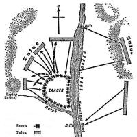
It's name being symbolic of royalty (“Kroon” is Dutch for crown), Kroonstad has very humble beginnings. It was named after Voorktrekker Sarel Cilliers' horse, who drowned in a stream here. (Charl Arnoldus Cilliers was a Voortrekker leader and a preacher. With Andries Pretorius, he led the Boers to a huge victory over the Zulus at the Battle of Blood River in 1838.)
The Vaal River runs through the City of Kroonstad, with its banks of willows and poplar trees, laid out in parks.
The main industry of Kroonstad is agriculture. It is the centre of a rich agricultural district, producing maize, wheat, dairy and meat products and wool. Kroonstad is also a busy transportation centre with Marshalling Yards, Grain Elevators, and engineering works. It is the Northern educational focus of the Province, with vocational and trade Schools. It is within 64 km of the Free State goldfields, and there are coal and diamond Mines to the North. In the 2001 Census; there was a Population of 23,994 people.
In 1975, Winnie Mandela was incarcerated here at the Kroonstad Prison. In February 1975, our founding President, the late Nelson Mandela, wrote her a letter where he was encouraging her not to let this Prison break her down!
At the official renaming ceremony of the Kroonstad Correctional Centre, to the 'Bizzah Makhate Correctional Centre". (This name pays tribute to the late Comrade; Wilfred Sefularo ‘Bizzah’ Makhate who was incarcerated at this facility in the eighties!) Minister Sibusiso Joel "S'bu" Ndebele (born 17 October 1948), led this ceremony. He was the Minister of Correctional Services, serving from 2012 to 2014. He has been on the National Executive Committee (NEC) of the African National Congress (ANC) since 1997, and was the Provincial Chair of the ANC from 1998 to 2008. Minister Ndebele said: “The colonial powers used incarceration as a way of subjugating the indigenous populations. Oliver Tambo, in his December 1964 Foreword to President Nelson Mandela’s book “No Easy Walk to Freedom,” writes about South Africa’s high prison population and notes: ‘South African apartheid laws turn innumerable innocent people into ‘criminals’. Apartheid stirs hatred and frustration among people...every case in court, every visit to the prisons to interview clients, reminded us [me & Mandela] of the humiliation and suffering burning into our people.’

Geolocation
-27° 39' 14.4", 27° 8' 45.6"

Matroosfontein

This Area was established in the Years of Apartheid! It is perfectly positioned; as it is extremely close to the Cape Town International Airport (less than about four kilometres, in fact) and is fewer than 20 kilometres from the City Bowl. This Suburb has a deep, poignant History, and is a fascinating Area, to explore and discover. Originally, home to larger segments of the Coloured Community and Working Class! It now has developed into an Area that showcases the food, music, beliefs and faces of these folk. Matroosfontein Population is now a full spectrum of the South Africans. Bordering on: the Township of Gugulethu, Bonteheuwel, Elsie’s River, Goodwood, Athlone, Belhar and Parow Industrial. Matroosfontein is just one more of the Areas that define the character and charm of Cape Town and South Africa, and offers locals and visitors alike the opportunity to tour this unique place!

Geolocation
-33° 33' 36", 18° 21'

Bonteheuwel

Bonteheuwel is a coloured Township situated North of Cape Town. It was created in the 1960's as a "Dumping Site" for coloured people, who had been forced to move out of Cape Town. This was a result of the Group Areas Act of 1950, were the land was divided into: blacks and whites distinct residential zones, the beginning of Apartheid! This act established the distinct areas of South Africa in which members of each race could live and work, typically setting aside the best urban, industrial, and agricultural areas for whites. The area was conceived as a letting scheme owned by the then Cape Town City. The construction of housing in Bonteheuwel (proper) started in 1961 and was completed in 1964.
In the 2001 national census, Bonteheuwel had a population of 55 707, of whom 95% were classified as coloured and 4% as Black African, indicating the results of the Group Areas Act. Afrikaans is the dominant language at 76%, while English is spoken as a home language by a further 22%. The housing profile of Bonteheuwel is dominated by brick houses on separate stands in which 72% of the population lives, followed by semi-detached houses in which a further 11% of population lives, while backyard dwellings – both brick structures and informal dwellings – are home for a further 11% of the people.
This Area is Bonteheuwel is a coloured Township situated North of Cape Town. It was created in the 1960's as a "Dumping Site" for coloured people, who had been forced to move out of Cape Town. This was a result of the Group Areas Act of 1950, were the land was divided into: blacks and whites distinct residential zones, the beginning of Apartheid! This act established the distinct areas of South Africa in which members of each race could live and work, typically setting aside the best urban, industrial, and agricultural areas for whites. The area was conceived as a letting scheme owned by the then Cape Town City. It comprised four areas, namely Bonteheuwel (proper), Bluegum, Netreg and Kalksteenfontein. The construction of housing in Bonteheuwel (proper) started in 1961 and was completed in 1964.
In the 2001 national census, Bonteheuwel had a population of 55 707, of whom 95% were classified as coloured and 4% as Black African, indicating the results of the Group Areas Act. Afrikaans is the dominant language at 76%, while English is spoken as a home language by a further 22%. The housing profile of Bonteheuwel is dominated by brick houses on separate stands in which 72% of the population lives, followed by semi-detached houses in which a further 11% of population lives, while backyard dwellings – both brick structures and informal dwellings – are home for a further 11% of the people.
This Area is predominantly is made up of financially and impoverished, struggling community!

Bonteheuwel's Freedom Square is now officially a Provincial Heritage Site. The square, in the suburb's central business district (CBD), holds historic significance. It is the place where anti-apartheid freedom fighters often gathered to strategize and organise. During the liberation struggle, Freedom Square was a space for congregation and political meetings. The Bonteheuwel Civic, the library, the staircases and platforms surrounding the library would act as assembly and meeting points, which provided a platform for activists to address crowds.

Geolocation
-33° 57' 3.6", 18° 32' 13.2"