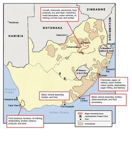
This map shows the territory of the ten homelands designated by the apartheid government along with the major industrial areas and ports.Image sourceBy MATRIX, Michigan State University