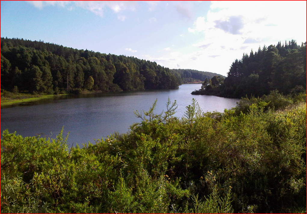
The Limpopo Province covers the Area that lies Northern most in South Africa, just South of Zimbabwe. It was first called the Northern Province, but this was changed in 2002. The Limpopo Province was part of the old Transvaal and includes many old homelands like Venda, Gazankulu and Lebowa. The Limpopo River is a river the South African Province, Botswana, Zimbabwe and Mozambique. It's known for bushveld and wildlife Reserves, including part of Kruger National Park.
in southeast Africa that rises as the Krokodil Rivier, (Crocodile River translated into English-the Crocodile River) in the Witwatersrand, South Africa, and flows on a semicircular course first Northeast and then east for about 1,800 km, to the Indian Ocean. From its source the river flows Northward to the Magaliesberg, cutting the Hartbeespoort Gap, which is the site of an irrigation Dam. It then flows across the fertile Bushveld basin to open granite country, where it is joined on the left bank by the Marico River. From there it is known as the Limpopo River. (The name may be Sotho for “river of the waterfall.”) Turning North Eastward, the River forms the border for about 400 km between the Limpopo Province and Botswana, receiving seasonal tributaries. After swinging Eastward between the Limpopo Province and Zimbabwe, the Limpopo River receives the Shashi River and flows about 240 km to Mozambique, where it reaches the fall line. In this zone the River drops about 250 metres, with most of the drop concentrated in 43 km of rapids, especially those at Malala River, Molukwe River, and Quiqueque River. The Limpopo River is unnavigable until its confluence with the Olifants River, 209 km from the coast. Though partially blocked by a sandbar at its outlet, the River can be entered by Coastal steamers at high tide. The Limpopo River is dammed about 62 miles (100 km) from its mouth—near Guijá, where an agricultural Settlement has been developed.
The Crocodile River headwaters, are at Hartbeespoort Dam. Which has an annual discharge of 152,954,000 cubic metres of water. The maximum flow is in February with the minimum in August months. The Limpopo River’s lower and middle courses reflect climatic changes, drying to a series of pools in the winter months and reaching flood proportions in the Summer.
Capital: Polokwane (before 2002, its name was Pietersburg)
Main languages: Sesotho sa Leboa, Shangaan
Premier: Cassel Mathle
First premier (1994): Ngoako Ramatlhodi
Limpopo's claim to fame:
-Mapungubwe
 The golden rhino from Mapungubwe.
Mapungubwe was a kingdom in Northern South Africa a thousand Years ago. The people of Mapungubwe mined gold and traded with other parts of the world, even China. They left many objects that show how they lived and how rich they were, like this golden rhino that was made from pure gold. Mapungubwe is a World Heritage Site, which means that it is a very important place in the history of the world, not only South Africa, and it must be protected so that people can see it and know what it was for many years to come. Mapungubwe is also the name of one of South Africa’s highest orders of merit, a very special prize for people who served South Africa.
-Makapansgat
Another important archaeological site in Limpopo is Makapansgat near Mokopane (the old Potgietersrus). People lived there about 1,5 million to 100 000 years ago, and left objects and fossils. It was also the place where a battle between Boers and the Kgotla was fought in 1854. The Boers won, and they named a Town nearby after their hero of the battle, Piet Potgieter. The town was Potgietersrus, but in 2002 the name was changed to Mokopane. Chief Mokopane was the chief of the Kgotla who lost against the Boers.
-Baobab trees
 A baobab tree in the Limpopo Province
Baobab trees are very large African trees. They are sometimes described as ‘upside-down’, because of the short branches that look like the roots of a tree. Baobabs grow very slowly, but they can live for thousands of years. Old and large Baobabs have hollow trunks, and animals and even people can stay in a Baobab trunk. Some of the Baobabs in the Limpopo Province are possibly even more than 3000 years old, and the biggest Baobab in the world can be found in Limpopo. One of the orders of merit of South Africa is called the: 'Order of the Baobab'.
Makalali Trail
A great trail for families or friends wanting to get out of the city, you’ll explore the Makalali Reserve (a Big 5 game reserve) and walk from campsite to campsite (or remain at the same campsite if you prefer). Your guide will make sure your group (of no more than eight) are taken care of and share amazing knowledge you as you try to spot some wild animals along your way. You can even work for some badges that 'Wildside Trails' hands out to recognise special moments and achievements (like the hippo sighting badge or night under the stars badge). You can also backpack this trail if you’d like. (Link in FURTHER READING)
