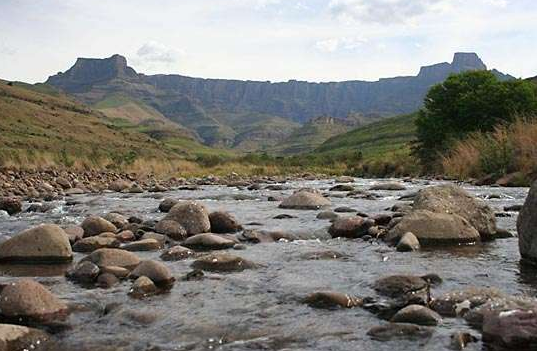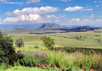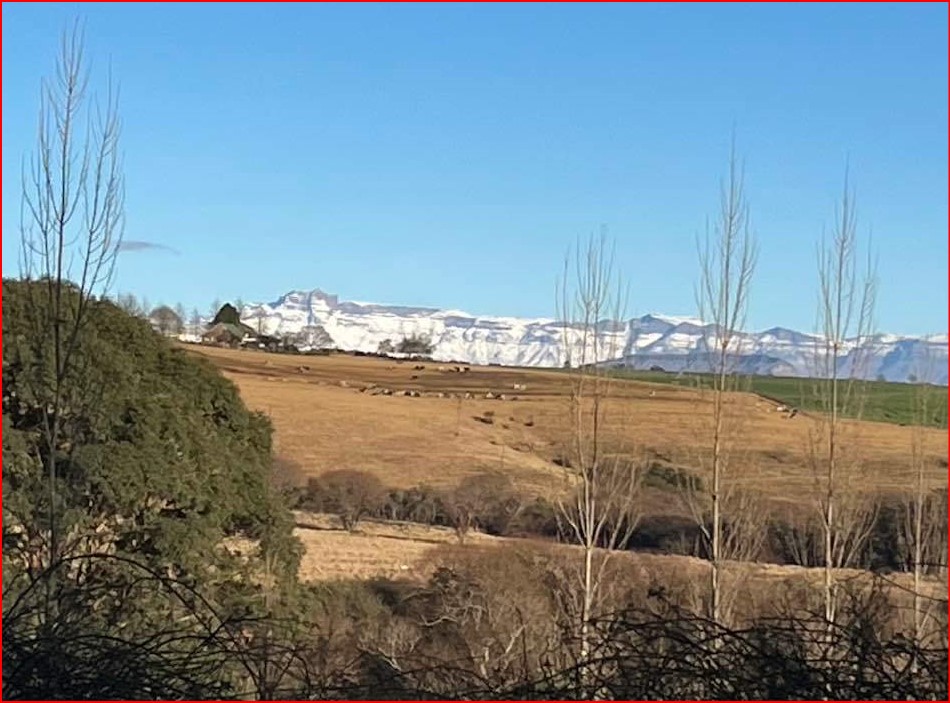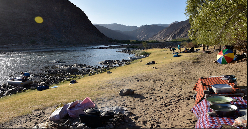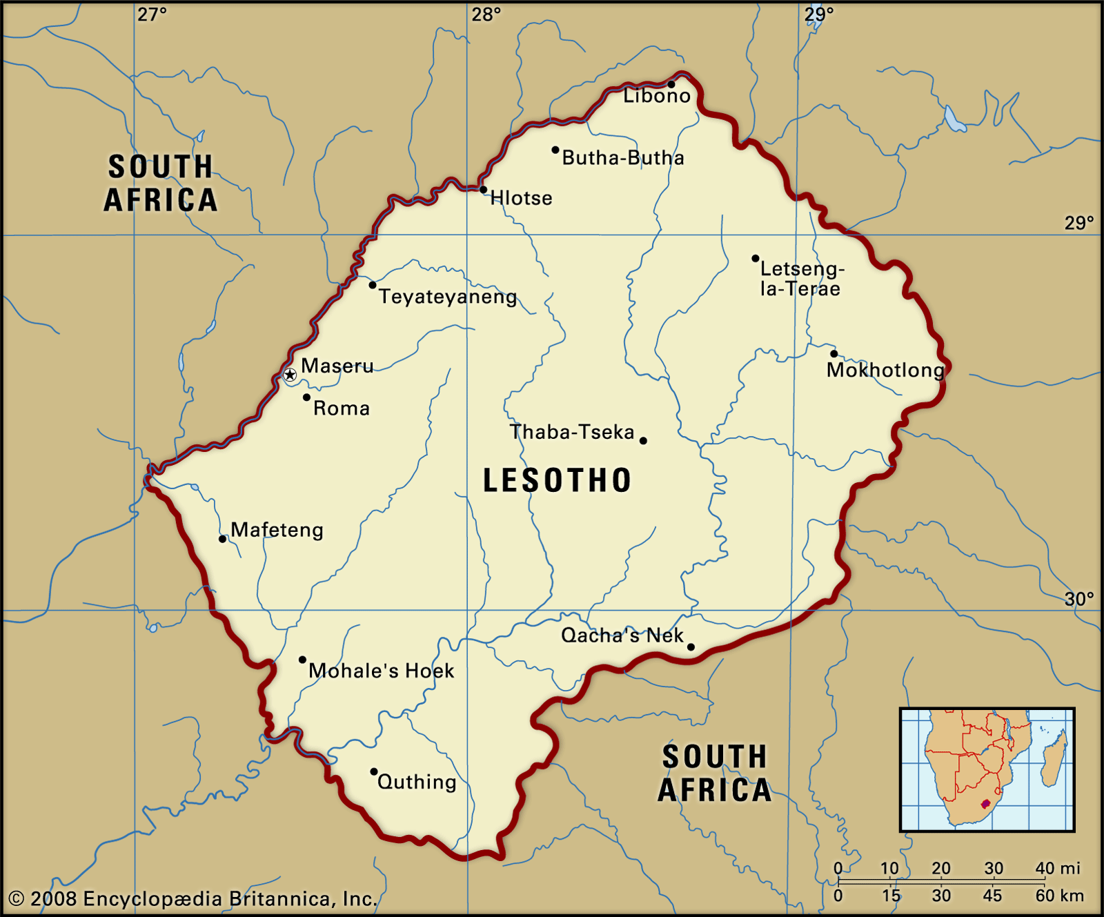
Two-thirds of the Country of Lesotho consists of Mountains. The highest Peak, Mount Ntlenyana, is 3,482 Metres above sea level. The Drakensberg range forms the Boundary with; 'KwaZulu-Natal'. The Maloti spurs of the Drakensberg, running North and South, join the main range in the North, forming a plateau from 2,700 to 3,200 metres, in elevation. This plateau is the centre of the cattle-raising and Agricultural Industries and is the source of South Africa’s two largest Rivers—the Eastward-flowing Tugela and the Westward-flowing Orange—as well as tributaries of the Caledon (Mohokare). Three other important rivers in Lesotho are the Senqunyane in the centre of the Country, the Kometspruit in the Southwest, and the Matsoku in the Northeast. The Foothills, with elevations averaging between 1,800 and 2,100 Metres. They descend in undulating slopes to the West, where the lowlands bordering Free State rise to elevations of 1,500 to 1,800 Metres. The mountain soils are of Basaltic origin- (composed of, relating to, or resembling basalt, a dark-colored, fine-grained igneous rock and are shallow but rich.)The soils of the Lowlands derive mainly from the underlying Sandstone. Extensive erosion has severely damaged the soils throughout the Country.
Lesotho's had a population of 2 160 349 million people in 21/07/2021, of which most live below the poverty line! A large portion of the population, have family members that migrate for work prospects, to a neighbouring Country like South Africa.
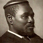
Various Sotho societies arrived in Basutoland and the Free State areas in the seventeenth Century. King Moshoeshoe I, united the Sotho tribes against the Zulu invaders. During the 19th Century, the territory of Basutoland played an important role in the Colonial History of Southern Africa. The first formal contact between European immigrants and its indigenous residents was probably made in 1833 when three French missionaries, Thomas Abousset, Eugene Casalis and Constant Gosselin, visited Moshoeshoe, king of the newly formed baSotho Nation, and obtained permission to establish a mission station at Morija. They were followed in October 1834 by a research party led by Dr Andrew Smith.
After the first visits by Missionaries groups of migrant Dutch farmers, some of whom were granted land for settlement under baSotho customary law, infiltrated the country. In 1836 the territory was invaded by groups of Voortrekkers who, despite having signed a "treaty of friendship" with the baSotho in 1837, declared a separate Republic on their lands in 1843.
A series of inconclusive territorial wars between the baSotho and Dutch slowly eroded baSotho land holdings in what was to become the Orange Free State despite the intervention of the British at the Cape. Despite having managed to retain his independence against the Voortrekkers, Moshoeshoe realised that the future of baSotho sovereignty lay in a close association with the British. As a result, in 1862, he wrote to the newly-appointed Governor of the Cape, Sir Philip Wodehouse, suggesting that an alliance be formed between the two territories. On 12 March 1868, acting in the face of continued Voortrekker aggression; Wodehouse issued a proclamation declaring Bautoland a British Protectorate. This was formalised by the baSotho on 15 April 1868. In 1871 Basutoland was annexed into the Cape Colony.
Boundary negotiations with the Voortrekkers were concluded in February 1869, during which large tracts of land in the Ficksburg, Fouriesburg, Ladybrand, Thaba 'Nchu, Wepener and Zastron districts were ceded to the Orange Free State. Within a year the first British administrators began to arrive in Basutoland and although many of its administrative functions were integrated with those of the Cape, it retained its autonomous status as a High Commission Territory. For the purpose of administering the territory was originally divided into four districts:
* Leribe, whose magisterial seat was located at Thlotse Heights, later renamed Leribe. In 1882 it contained 12 trading stations and three missions.
* Berea, whose magisterial seat was initially located at Advance Post. In 1886 this was transferred to Berea, which was renamed Teyateyaneng in about 1888.
* Thaba Bosigo, which was probably the most prosperous district of Basutoland.
* Cornet Spruit, whose magisterial seat was located at Mohale's Hoek.
The following census figures were available for Basutoland in 1875:
BASUTOLAND, a territory of ......... 128,176 residents 1,489 literate
District of Berea .............. 17,348 residents 131 literate
District of Cornet Spruit ...... 27,291 residents 295 literate
District of Leribe ............. 31,434 residents 43 literate
District of Thaba Bosigo ....... 52,203 residents 1,020 literate
The total population for the territory had risen to 348,848 residents. According to UNESCO, in 2014. Lesotho had an adult literacy rate of 76.64%. Only in a few countries female literacy rates are above male literacy rates, in Lesotho, 84.93% of all women aged 15 years and older are literate, compared to 67.75% of men.
In 1959, Basutoland became a British Colony and was called Territory: 'Basutoland'. Basutoland gained full independence from Britain on 4 October 1966 and became known as Lesotho. Jonathan Leabua became the country's first Prime Minister. Lesotho was also rocked by a military takeover, which forced King Moshoeshoe II into exile. Constitutional government was restored in 1993 after 23 years of authoritarian rule, which included seven years of military rule. Lesotho is the main supplier of water to South Africa and in turn receives electricity from South Africa. It is completely landlocked by South Africa. (A number of interesting links have been added in: 'Further reading')
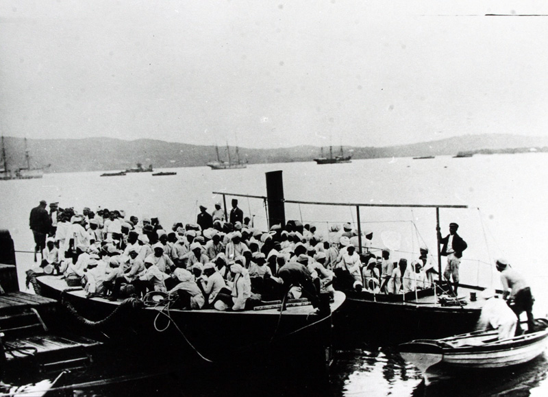
A member of Parliament: Leon Schreiber, (Dr Leon Schreiber was appointed as Minister of Home Affairs from 3 July 2024. He is a Member of Parliament for the Democratic Alliance)has announced the extension of the Lesotho Exemption Permits by another 18 months. The announcement comes weeks after the arrest of more than 480 undocumented Basotho workers in South Africa. Most of them have been released. The collapse of Lesotho’s textile industry has forced more and more workers to seek jobs in South Africa. South Africa’s decision to extend the Lesotho Exemption Permits by 18 months is a lifeline for thousands of Basotho workers in South Africa living under fear of arrests and deportations. (LINK PROVIDED IN FURTHER READING)
The Lesotho Special Permit (LSP) system- which is a South African permit system launched in 2016 to legalize the stay of Basotho nationals in South Africa. was first introduced in 2015 by then Home Affairs Minister Malusi Gigaba to regularise the stay of undocumented Basotho nationals already living, working, or studying in South Africa. It allowed Basotho to reside in the country under relaxed conditions, granting them work, study, or business rights while suspending deportations of permit holders. A total of 90,314 permits were issued under the LSP, but only to Basotho who already resided in South Africa and held valid passports at the time. When the LSP expired in 2019, it was replaced by the four-year Lesotho Exemption Permit, later extended by then Home Affairs Minister Aaron Motsoaledi to cover approximately 54,653 Basotho nationals. That extension was due to end next month, before Schreiber’s latest decision to add another 18 months. The renewal comes amid economic collapse in Lesotho’s textile industry, once the country’s largest private employer.
“There are numerous reports of human rights violations during arrests conducted by the South African Police Service,” he said. “Migrants are often denied the right to contact their families or seek legal representation, an essential safeguard that is being systematically ignored.”