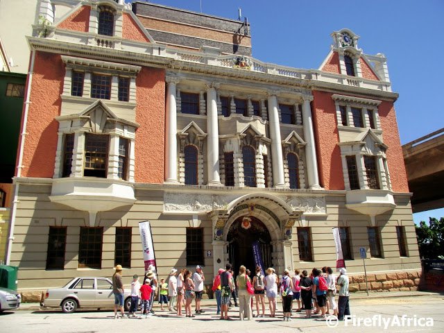
Known popularly as the 'White Building'. The old Harbour Board Building was used for 70 years for harbor administration by the South African Railways and Harbours, in Port Elizabeth. Sir Rufane Donkin was acting Governor at the Cape from 1820 to 1821 during the absence of Lord Charles Somerset. In honour of his late wife, Donkin declared he the Settlement name; 'Port Elizabeth'. Finally in 2021, with the aim to distance South Africa from its colonial past and represent the authentic South Africa, the name was changed to Gqeberha. (This not only embraced its Xhosa Heritage but celebrated its iconic River.) It was Boy Lamani of KwaMgxaki, who proposed the name Gqeberha as a substitute for PE and South Africa’s Arts and Culture Minister Nathi Mthethwa who announced the name change.
The foundation stone was laid by Mr. J. Searle, Managing Commissioner of thePort Elizabeth Harbour Board. This was on the 14th January 1904. The exterior of the building has massive and impressive stonework and the interior has richly ornamented woodwork and stained glass windows. The building is regarded as one of the best examples of Art Nouveau architecture in South Africa. It was proclaimed a National Monument in 1968, and was restored in 1998; by Portnet and the Architect, John Rushmere.
The old Harbour Board Building in Flemming Street in the city centre was used as: The Port Elizabeth Harbour's Administration Building for 70 years.
The building is currently being used by a college.