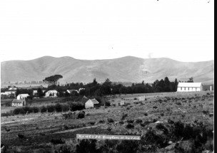
In 1802 William Anderson and Cornelius Kramer, of the London Missionary Society, established a station among the Griqua at Leeuwenkuil. Thesite proved to be too arid for cultivation, and in about 1805 theymoved the stationto another spring further up the valley and called it Klaarwater. Regrettablytheir second choice was little better than their first, and for many years alack of water prevented any further development. William Burchell visited herein October 1811 and reported that:
"The trees of my imagination vanished, leaving nothing in reality buta few which the missionaries themselves had planted; the church sunkto a barn-like building of reeds and mud; the village was merely arow of half a dozen reed cottages; the river was but a rill; and thesituation an open, bare, and exposed place, without any appearance ofa garden, excepting that of the missionaries."
The Griqua were a Khoikhoi group of migrant pastoralist who, over the years,intermarried with European colonists. Not finding a place in either colonialor indigenous societies, the Griqua slowly migrated northwards into the morearid regions of the southern African hinterland.In June 1813 Klaarwater was renamed Griquatown by the Rev John Campbell who wasvisiting the region at the time:
"The whole people likewise resolved that henceforth they should becalled Griquas, instead of Bastard Hottentots, and the place calledGriqua-town, instead of Klaar Water."
When James Backhouse visited them in September 1839, he was greeted by scenes of abject poverty:
"The gardens and adjacent lands were desolate; a solitary peach-treeand a few fig-trees were all that survived in the former; and few ofthe Griquas remained upon the place. Many of the houses, that hadbeen forsaken in consequence of the drought, were in ruins."
By the time John MacKenzie visited in 1859 little had changed:
"At Griqua Town everything bore the evidence of former prosperity ...the gardens and fields were now parched up and quite uncultivated,while many of the houses were deserted and in ruins."
In 1861 most of the inhabitants of Griquatown collectively sold off their land holdings in the region and migrated to Griqualand East. Thereafter Griquatown began to be developed by Dutch colonists, and in 1891 the census indicated that the village had a population of 401. By 1904 this number had risen to 1,244.
On 17 November 1899 Griquatown was captured by Boer forces and probably remainedin their hands intermittently until 7 June 1900 when British forces under Lt-GenSir Charles Warren entered the village. On 27 October Boer forces returned toGriquatown and ransacked its post office, inflicting extensive damage upon itsestablishment in the process.